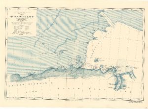
Map 3698: Australasian Antarctic Expedition 1911-14 : Queen Mary Land showing tracks of the Sledging Parties from the Main Base.
Map details
| Map Number | 3698 |
| Title | Australasian Antarctic Expedition 1911-14 : Queen Mary Land showing tracks of the Sledging Parties from the Main Base. |
| Edition | - |
| Scale | 1 : 1 500 000 |
| Publication date | 1914 |
| Publisher | - |
| Spatial coverage |
( 86.0000° -63.5000°)
,
(102.0000° -63.5000°)
,
(102.0000° -67.9167°)
( 86.0000° -67.9167°) |
| Projection | - |
| Physical size | 38 x 52.5 cm |
| Notes | Conical projection |
| Reference | 1086 |
| Keywords | Queen Mary Land , Australasian Antarctic Expedition , Kaiser Wilhelm Ii Land , Gaussberg , Drygalski Island , Shackleton Shelf , Termination Ice Tongue , Masson Island , Bay Of Winds , Denman Glacier , Scott Glacier , Ship Tracks , Historical |
Downloads
No downloads available.
This is a hard copy map. See information about obtaining copies of hard copy maps.
Map Lists
This map belongs to the following lists. Use the link on the list to see all maps belonging to that list
Additional Information
Preview