Royal Geographical Society maps
View All Map ListsShowing 21 to 40 of 42 maps. On page 2 of 3, go to the Previous Page or Next Page
Maps to illustrate the paper by Dr. J.B. Charcot on the French Antarctic Expedition 1908-1910. View Map Details
Map ID - 3691
Published On - 1911 Scale - 1 : 5 000 000 Physical Size- 40.5 x 35 cm 
|
Northern Base, Argentine Islands : British Graham Land Expedition. February 1935 - February 1936 View Map Details
Map ID - 3712
Published On - June-1938 Scale - 1 : 15 000 Physical Size- 24.7 x 32.5 cm 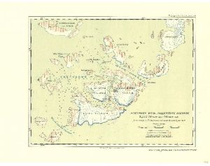
|
Preliminary Chart showing the Deep Sea Soundings taken on board the "Aurora" during the 1st and 2nd years work of the Australasian Antarctic Expedition under Dr. Douglas Mawson 1912-13. View Map Details
Map ID - 3695
Published On - 1913 Scale - 1 : 15 000 000 Physical Size- 43 x 38.3 cm 
|
Queen Maud Range and Axel Heiberg Glacier Region View Map Details
Map ID - 3720
Published On - December-1963 Scale - 1 : 316 800 Physical Size- 60.5 x 38 cm 
|
Recent Work of Norwegian Expeditions in the Antarctic Regions to illustrate a paper by Prof. Olaf Holtedahl View Map Details
Map ID - 3703
Published On - November-1931 Scale - 1 : 30 500 000 Physical Size- 36 x 42 cm 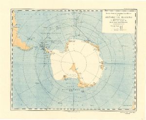
|
Regional Map showing the area covered by the Australasian Antarctic Expedition 1911-14 under Sir Douglas Mawson View Map Details
Map ID - 3696
Published On - 1914 Scale - 1 : 15 000 000 Physical Size- 38 x 39 cm 
|
Routes of Captain R. Amundsen's South Polar Expedition 1911-12 View Map Details
Map ID - 3694
Published On - 1913 Scale - 1 : 6 000 000 Physical Size- 36.5 x 56 cm 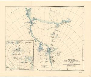
|
Sketch Map showing the first year's work of the National Antarctic Expedition to illustrate the paper by Sir Clements Markham, K.C.B View Map Details
Map ID - 3680
Published On - 1903 Scale - 1 : 6 000 000 Physical Size- 40.5 x 45 cm 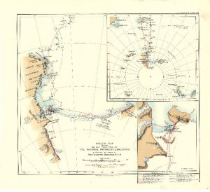
|
Sketch Map to illustrate the Exploration of the Swedish Antarctic Expedition 1902-3 View Map Details
Map ID - 3682
Published On - 1904 Scale - 1 : 3 000 000 Physical Size- 24.5 x 38.7 cm 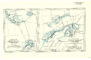
|
Sketch Map to illustrate the paper by Dr. Charcot on the French Antarctic Expedition 1903-5. View Map Details
Map ID - 3687
Published On - 1905 Scale - 1 : 2 500 000 Physical Size- 35.5 x 40.7 cm 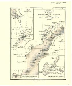
|
Sketch Maps showing the Track and Explorations of the German South Polar Expedition 1902-3 by Dr. Von Drygalski. View Map Details
Map ID - 3684
Published On - 1904 Scale - 1 : 6 000 000 Physical Size- 29 x 43.5 cm 
|
Sketch of Danco Land, the Belgica Strait and Palmer Archipelago surveyed by Captain G. Lecointe. 1898 View Map Details
Map ID - 3679
Published On - 1901 Scale - Not Entered Physical Size- 28 x 39 cm 
|
South Polar Regions to illustrate the paper by H.R. Mill, D.Sc., LL.D. View Map Details
Map ID - 3693
Published On - 1912 Scale - 1 : 40 000 000 Physical Size- 34.5 x 29.5 cm 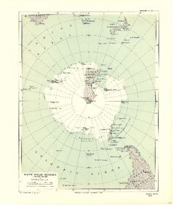
|
South Polar Regions with the Antarctic Continent drawn to illustrate the probable topography as deduced from present available data by D. Mawson, D.Sc. B.E. View Map Details
Map ID - 3692
Published On - 1911 Scale - 1 : 40 000 000 Physical Size- 33 x 37 cm 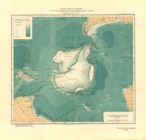
|
South Shetland Islands : Surveys of the R.R.S. Discovery II 1935 View Map Details
Map ID - 3708
Published On - 1936 Scale - 1 : 1 250 000 Physical Size- 17.5 x 25.3 cm 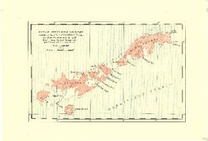
|
Southern Base, Marguerite Bay : B. G. L. E. March 1936 - March 1937. View Map Details
Map ID - 3711
Published On - May-1938 Scale - 1 : 500 000 Physical Size- 24.5 x 17 cm 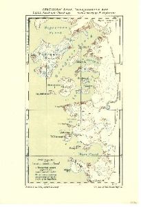
|
Stations of the Circumpolar Cruises Winter 1932, and of the Falkland Islands Sector Season 1932-33 View Map Details
Map ID - 3707
Published On - May-1934 Scale - 1 : 45 000 000 Physical Size- 24.7 x 48 cm 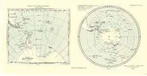
|
Surveys and Soundings of the R.R.S. Discovery II 1929-30 View Map Details
Map ID - 3704
Published On - March-1932 Scale - 1 : 2 250 000 Physical Size- 24.5 x 36.3 cm 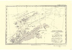
|
The Changing Map of Alexander and Charcot Island (10 sketch maps on 1 sheet covering period 1821-1960) View Map Details
Map ID - 3718
Published On - June-1963 Scale - 1 : 7 000 000 Physical Size- 25.5 x 35.3 cm 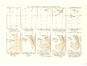
|
The Course of Antarctic Exploration Between Longitudes 20°W and 110°E. View Map Details
Map ID - 3715
Published On - September-1939 Scale - 1 : 3 000 000 Physical Size- 44 x 62.5 cm 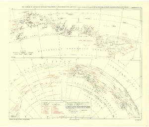
|
Showing 21 to 40 of 42 maps. On page 2 of 3, go to the Previous Page or Next Page