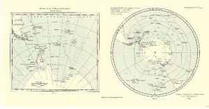
Map 3707: Stations of the Circumpolar Cruises Winter 1932, and of the Falkland Islands Sector Season 1932-33
Map details
| Map Number | 3707 |
| Title | Stations of the Circumpolar Cruises Winter 1932, and of the Falkland Islands Sector Season 1932-33 |
| Edition | - |
| Scale | 1 : 45 000 000 |
| Publication date | May 1934 |
| Publisher |
Royal Geographical Society (United Kingdom)
|
| Spatial coverage |
(-180.0000° -30.0000°)
,
(180.0000° -30.0000°)
,
(180.0000° -90.0000°)
(-180.0000° -90.0000°) |
| Projection | Not Given |
| Physical size | 24.7 x 48 cm |
| Notes | Two maps on the one sheet |
| Reference | 1273 |
| Keywords | Second Antarctic Commission R.R.S. "Discovery Ii" , Falkland Islands , Scotia Sea , Drake Passage , Bellingshausen Sea , South Sandwich Group , South Georgia , South Orkneys , South Shetlands , Ship Tracks , Historical |
Downloads
No downloads available.
Map Lists
This map belongs to the following lists. Use the link on the list to see all maps belonging to that list
Additional Information
Preview