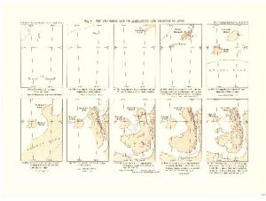
Map 3718: The Changing Map of Alexander and Charcot Island (10 sketch maps on 1 sheet covering period 1821-1960)
Map details
| Map Number | 3718 |
| Title | The Changing Map of Alexander and Charcot Island (10 sketch maps on 1 sheet covering period 1821-1960) |
| Edition | - |
| Scale | 1 : 7 000 000 |
| Publication date | June 1963 |
| Publisher |
Royal Geographical Society (United Kingdom)
|
| Spatial coverage |
( -77.0000° -68.0000°)
,
( -67.0000° -68.0000°)
,
( -67.0000° -72.0000°)
( -77.0000° -72.0000°) |
| Projection | Not Given |
| Physical size | 25.5 x 35.3 cm |
| Reference | 1439 |
| Keywords | Alexander Island , Charcot Island , Ship Tracks , Historical |
Downloads
No downloads available.
This is a hard copy map. See information about obtaining copies of hard copy maps.
Map Lists
This map belongs to the following lists. Use the link on the list to see all maps belonging to that list
Additional Information
Preview