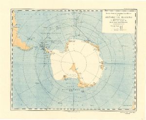
Map 3703: Recent Work of Norwegian Expeditions in the Antarctic Regions to illustrate a paper by Prof. Olaf Holtedahl
Map details
| Map Number | 3703 |
| Title | Recent Work of Norwegian Expeditions in the Antarctic Regions to illustrate a paper by Prof. Olaf Holtedahl |
| Edition | - |
| Scale | 1 : 30 500 000 |
| Publication date | November 1931 |
| Publisher |
Royal Geographical Society (United Kingdom)
|
| Spatial coverage |
(-180.0000° -30.0000°)
,
(180.0000° -30.0000°)
,
(180.0000° -90.0000°)
(-180.0000° -90.0000°) |
| Projection | Not Given |
| Physical size | 36 x 42 cm |
| Reference | 1241 |
| Keywords | Olaf Holtedahl , Norwegian Expeditions , Ship Tracks , Historical |
Downloads
No downloads available.
This is a hard copy map. See information about obtaining copies of hard copy maps.
Map Lists
This map belongs to the following lists. Use the link on the list to see all maps belonging to that list
Additional Information
Preview