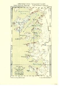
Map 3711: Southern Base, Marguerite Bay : B. G. L. E. March 1936 - March 1937.
Map details
| Map Number | 3711 |
| Title | Southern Base, Marguerite Bay : B. G. L. E. March 1936 - March 1937. |
| Edition | - |
| Scale | 1 : 500 000 |
| Publication date | May 1938 |
| Publisher |
Royal Geographical Society (United Kingdom)
|
| Spatial coverage |
( -67.7500° -67.5000°)
,
( -66.4500° -67.5000°)
,
( -66.4500° -68.4000°)
( -67.7500° -68.4000°) |
| Projection | Not Given |
| Physical size | 24.5 x 17 cm |
| Notes | From a survey by A. Stephenson |
| Reference | 1334 |
| Keywords | Marguerite Bay , Pourquoi Pas Island , Bourgeois Fjord , Square Bay , Neny Fjord , Millerand Island , Horseshoe Island , British Graham Land Expedition , Historical |
Downloads
No downloads available.
This is a hard copy map. See information about obtaining copies of hard copy maps.
Map Lists
This map belongs to the following lists. Use the link on the list to see all maps belonging to that list
Additional Information
Preview