Map 3708: South Shetland Islands : Surveys of the R.R.S. Discovery II 1935
Map details
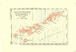
| Map Number | 3708 |
| Title | South Shetland Islands : Surveys of the R.R.S. Discovery II 1935 |
| Edition | - |
| Scale | 1 : 1 250 000 |
| Publication date | 1936 |
| Publisher |
Royal Geographical Society (United Kingdom)
|
| Spatial coverage |
( -61.8333° -61.7667°)
,
( -57.1667° -61.7667°)
,
( -57.1667° -63.0667°)
( -61.8333° -63.0667°) |
| Projection | Not Given |
| Physical size | 17.5 x 25.3 cm |
| Notes | Surveys of the R.R.S. "Discovery II" 1935 including the corrections of 1930. Based on Admiralty chart no. 3205 (Sept.1927 edition) with corrections in red. |
| Reference | 1306 |
| Keywords | South Shetland Islands , R.R.S. "Discovery Ii" , Livingston Island , King George Island , Nelson Island , Roberts Island , Greenwich Island , Snow Island , Historical |
Downloads
No downloads available.
This is a hard copy map. See information about obtaining copies of hard copy maps.
Map Lists
This map belongs to the following lists. Use the link on the list to see all maps belonging to that list
Additional Information
Preview