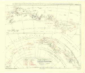
Map 3715: The Course of Antarctic Exploration Between Longitudes 20°W and 110°E.
Map details
| Map Number | 3715 |
| Title | The Course of Antarctic Exploration Between Longitudes 20°W and 110°E. |
| Edition | - |
| Scale | 1 : 3 000 000 |
| Publication date | September 1939 |
| Publisher |
Royal Geographical Society (United Kingdom)
|
| Spatial coverage |
( -20.0000° -60.0000°)
,
(110.0000° -60.0000°)
,
(110.0000° -80.0000°)
( -20.0000° -80.0000°) |
| Projection | Gnomonic |
| Physical size | 44 x 62.5 cm |
| Notes | Map to accompany the paper by Mr. Lars Christensen on "Recent reconnaissance flights in the Antarctic". Compilation and outline by H.F. Milne; writing by C.E. Denny. |
| Reference | 1351 |
| Keywords | Lars Christensen , Antarctic Exploration , Ship Tracks , Historical |
Downloads
No downloads available.
Map Lists
This map belongs to the following lists. Use the link on the list to see all maps belonging to that list
Additional Information
Preview