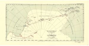
Map 3709: Map to illustrate the paper on the "First Crossing of Antarctica" by Lincoln Ellsworth
Map details
| Map Number | 3709 |
| Title | Map to illustrate the paper on the "First Crossing of Antarctica" by Lincoln Ellsworth |
| Edition | - |
| Scale | 1 : 12 000 000 |
| Publication date | March 1937 |
| Publisher |
Royal Geographical Society (United Kingdom)
|
| Spatial coverage |
( -20.0000° -60.0000°)
,
(160.0000° -60.0000°)
,
(160.0000° -90.0000°)
( -20.0000° -90.0000°) |
| Projection | Not Given |
| Physical size | 25 x 52 cm |
| Reference | 1321 |
| Keywords | Lincoln Ellsworth , Trans-Antarctic Flight , Historical |
Downloads
No downloads available.
This is a hard copy map. See information about obtaining copies of hard copy maps.
Map Lists
This map belongs to the following lists. Use the link on the list to see all maps belonging to that list
Additional Information
Preview