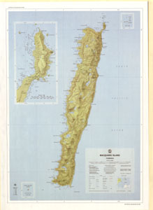
Map 42: Macquarie Island
Map details
| Map Number | 42 |
| Title | Macquarie Island |
| Edition | 1 |
| Scale | 1 : 50 000 |
| Publication date | November 1971 |
| Publisher |
Department of National Development, Division of National Mapping (Australia)
|
| Spatial coverage |
(158.6667° -54.4667°)
,
(159.0667° -54.4667°)
,
(159.0667° -54.8000°)
(158.6667° -54.8000°) |
| Projection | Transverse Mercator |
| Physical size | 81.5 x 58.5 cm |
| Notes | The map has an error of one minute in the longitude. Subtract one minute from longitudes shown on the map to reduce to true value. |
| Reference | NMP/68/025 (L6) |
| Keywords | Macquarie Island , Southern Ocean , Subantarctic , Sub-Antarctic , Station , North Head , Survey Marks , Topographic |
Downloads
This is a hard copy map that has been scanned. See information about obtaining copies of hard copy maps.
Map Lists
No maps lists available.
Additional Information
| Accuracy | The map has an error of one minute in the longitude. Subtract one minute from longitudes shown on the map to reduce to true value. |
| Vertical datum | msl |
| Vertical unit | Metres |
| Nomenclature | Australian Antarctic Gazetteer |
Preview