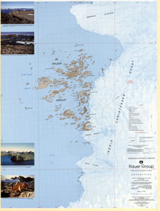
Map 48: Rauer Group / Princess Elizabeth Land
Map details
| Map Number | 48 |
| Title | Rauer Group / Princess Elizabeth Land |
| Edition | 1 |
| Scale | 1 : 50 000 |
| Publication date | June 1992 |
| Publisher |
Australian Antarctic Division (Australia)
|
| Spatial coverage |
( 77.4550° -68.6683°)
,
( 78.3233° -68.6683°)
,
( 78.3233° -69.0750°)
( 77.4550° -69.0750°) |
| Projection | Transverse Mercator |
| Physical size | 93 x 69 cm |
| Notes | This map was published as a double-sided map. This entry in the map catalogue refers the topographic map published in June 1992. Refer to Map No. 47 for the satellite image map published in June 1991. |
| Reference | Cat.No:L14 in 'ANARE Catalogue of Maps and Hydrographic Charts 1997' |
| Keywords | Ingrid , Christensen , Sorsdal , Prydz , Lookout , Lunnyy , Slon , Filla , Efemova , Hop , Flag , Shleyf , Shcherbinina , Mather , Varyag , Lokot , Pchelka , Hyslop , Torckler , Sapozhok , Rybachij , Cjubuk , Drakon , Macey , Law , Browns , Peters , Chaos , Ranvik |
Downloads
This is a hard copy map that has been scanned. See information about obtaining copies of hard copy maps.
- A print file (PDF)
- A zipped image (TIFF) of the topographic map for use in Oziexplorer
- A LZW compressed TIFF
Map Lists
This map belongs to the following lists. Use the link on the list to see all maps belonging to that list
Additional Information
| Horizontal datum | WGS84 |
| Magnetic variation | 76.6 degrees west in 1991 |
| Nomenclature | Australian Antarctic Gazetteer |
Preview