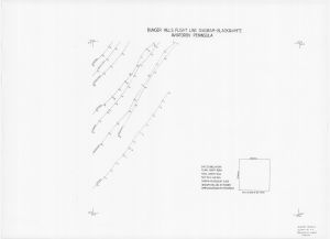
Map 855: Bunger Hills, Aviatorov Peninsula - Flight Line Diagram
Map details
| Map Number | 855 |
| Title | Bunger Hills, Aviatorov Peninsula - Flight Line Diagram |
| Edition | - |
| Scale | 1 : 50 000 |
| Publication date | 1986 |
| Publisher |
Division of National Mapping (Australia)
|
| Spatial coverage |
(101.0000° -66.1666°)
,
(101.5000° -66.1666°)
,
(101.5000° -66.3333°)
(101.0000° -66.3333°) |
| Projection | Not Given |
| Physical size | 50.5 x 70.5 cm |
| Notes |
Flight lines 25/1/86, 3-4/3/86 Hasselblad EL 500 camera Film: TRI X 400 ASA |
| Reference |
S11 / Q 47-83 VG Diagram compiled and drawn by T. McNamara |
| Keywords | Flight lines , aerial photography , Aviators Peninsula |
Downloads
This is a hard copy map that has been scanned. See information about obtaining copies of hard copy maps.
Map Lists
No maps lists available.
Additional Information
Preview