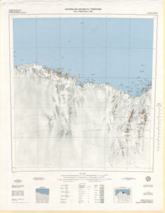
Map 89: Sheets SQ 40-41/15 & Part SR 40-41/3, Mawson & Mount Twintop, Australian Antarctic Territory, Mac. Robertson Land [SQ 41-42/13 & SR 41-42/1]
Map details
| Map Number | 89 |
| Title | Sheets SQ 40-41/15 & Part SR 40-41/3, Mawson & Mount Twintop, Australian Antarctic Territory, Mac. Robertson Land [SQ 41-42/13 & SR 41-42/1] |
| Edition | 1 |
| Scale | 1 : 250 000 |
| Publication date | September 1964 |
| Publisher |
Department of National Development, Division of National Mapping (Australia)
|
| Spatial coverage |
( 60.0000° -67.0000°)
,
( 63.0000° -67.0000°)
,
( 63.0000° -68.2500°)
( 60.0000° -68.2500°) |
| Projection | Universal Transverse Mercator |
| Physical size | 71 x 64.5 cm |
| Notes |
Mawson & Mount Twintop SQ 40-41/15 & Part SR 40-41/3 have been numbered according to a map numbering system adopted by Department of National Mapping in 1964 for the 1:250,000 series which is different from that adopted for the 1:1 million map series in 1971. The map should now be quoted as SQ 41-42/13 & SR 41-42/1. Reprinted 1983 with slightly different colouring. |
| Reference |
SQ40-41/15 & Part SR40-41/3 Cat.No:M20 in 'ANARE Catalogue of Maps and Hydrographic Charts 1997' |
| Keywords | Mawson , Mount Twintop , Mac Robertson Land , Sq40-41/15 , Sr40-41/3 , Low Tongue , Topographic , Mawson Coast , Framnes Mountains |
Downloads
This is a digital map available for downloading.
- PDF (First Edition 1964)
- A zipped image (TIF) for use in Oziexplorer
- PDF (Reprint 1983)
- A LZW compressed TIFF (First Edition 1964)
- A LZW compressed TIFF (Reprint 1983)
Map Lists
This map belongs to the following lists. Use the link on the list to see all maps belonging to that list
Additional Information
| Horizontal datum | International Spheroid |
| Nomenclature | Australian Antarctic Gazetteer |
Preview