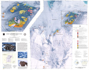
Map 920: Bedrock geology of the Bunger Hills and Denman Glacier Region
Map details
| Map Number | 920 |
| Title | Bedrock geology of the Bunger Hills and Denman Glacier Region |
| Edition | 1 |
| Scale | 1 : 250 000 |
| Publication date | 1994 |
| Publisher |
Australian Geological Survey Organisation (Australia)
|
| Spatial coverage |
( 98.0000° -65.6660°)
,
(102.0000° -65.6660°)
,
(102.0000° -67.5830°)
( 98.0000° -67.5830°) |
| Projection | Lambert Conformal Conic |
| Physical size | 89 x 112 cm |
| Notes | Contains explanatory notes and enlarged inset. Compiled by J.W. Sheraton and R.J. Tingey. Scanned image available. |
| Reference | SQ 47-48 (M34) |
| Keywords | Sq 47-48 (M34) , Bunger Hills , Denman Glacier , Obruchev Hills , Highjump Archipelago , Edisto Glacier , Shackleton Ice Shelf , Melba Peninsula , Geology |
Downloads
This is a hard copy map that has been scanned. See information about obtaining copies of hard copy maps.
Map Lists
This map belongs to the following lists. Use the link on the list to see all maps belonging to that list
Additional Information
Preview