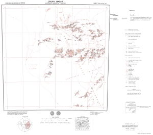
Map 944: Crohn Massif
Map details
| Map Number | 944 |
| Title | Crohn Massif |
| Edition | Preliminary |
| Scale | 1 : 250 000 |
| Publication date | 1972 |
| Publisher |
Bureau of Mineral Resources, Geology and Geophysics, Department of National Development, Canberra (Australia)
|
| Spatial coverage |
( 63.0000° -70.0000°)
,
( 66.0000° -70.0000°)
,
( 66.0000° -71.0000°)
( 63.0000° -71.0000°) |
| Projection | Universal Transverse Mercator |
| Physical size | 67.5 x 84 cm |
| Notes | Compiled by R.J. Tingey. 1:250,000 geological series. |
| Reference | SR 41-42/10, M36 |
| Keywords | Crohn Massif , Sr 41-42/10 , Prince Charles Mountains , Charybdis Glacier , Scylla Glacier , Athos Range , Aramis Range , Porthos Range , Geology |
Downloads
This is a hard copy map that has been scanned. See information about obtaining copies of hard copy maps.
- Image from scan (PDF)
- National Library of Australia Bib ID 4560443 (External site)
- A LZW compressed TIFF
Map Lists
This map belongs to the following lists. Use the link on the list to see all maps belonging to that list
Additional Information
| Nomenclature | Antarctic Names Committee of Australia |
Preview