SCAR Geosciences Map Catalogue
View All Map ListsShowing 181 to 200 of 416 maps. On page 10 of 21, go to the Previous Page or Next Page
Geological map of Trinity Peninsula (Duse Bay to Aitkenhead Glacier) View Map Details
Map ID - 8171
Published On - 1975 Scale - 1 : 200 000 Physical Size- -
No previews available
|
Geological map of Upper Mariner Glacier region View Map Details
Map ID - 8296
Published On - 1968 Scale - 1 : 800 000 Physical Size- -
No previews available
|
Geological map of Vestfold Hills View Map Details
Map ID - 8201
Published On - 1966 Scale - 1 : 100 000 Physical Size- -
No previews available
|
Geological map of western Enderby Land View Map Details
Map ID - 8218
Published On - 1966 Scale - 1 : 2 500 000 Physical Size- -
No previews available
|
Geological Sketch Map MacRobertson, Kemp and Enderby Lands View Map Details
Map ID - 8245
Published On - 1966 Scale - 1 : 500 000 Physical Size- - 
|
Geological sketch map of Candlemass Island View Map Details
Map ID - 8263
Published On - 1979 Scale - 1 : 12 500 Physical Size- -
No previews available
|
Geological sketch map of the area between Crane and Stubb Glaciers, Oscar II Coast View Map Details
Map ID - 8265
Published On - 1968 Scale - 1 : 200 000 Physical Size- -
No previews available
|
Geological sketch map of the Hektoria Glacier area, Oscar II Coast View Map Details
Map ID - 8264
Published On - 1968 Scale - 1 : 200 000 Physical Size- -
No previews available
|
Geological sketch map of the Hope Bay area View Map Details
Map ID - 8282
Published On - 1957 Scale - 1 : 200 000 Physical Size- -
No previews available
|
Geological sketch map of the Prince Olav Harbour area with station numbers, showing axial-plane cleavage and later north-south-trending fracture cleavage View Map Details
Map ID - 8258
Published On - 1972 Scale - 1 : 100 000 Physical Size- -
No previews available
|
Geological sketch map of the Prince Olav Harbour area with station numbers, showing bedding dip, major overfolds and geological sections View Map Details
Map ID - 8257
Published On - 1972 Scale - 1 : 100 000 Physical Size- -
No previews available
|
Geological sketch map of the Stromness Bay area with station numbers, showing axial-plane cleavage and later north-trending fracture cleavage View Map Details
Map ID - 8256
Published On - 1972 Scale - 1 : 50 000 Physical Size- -
No previews available
|
Geological sketch map of the Stromness Bay area with station numbers, showing major overfolds and geological sections View Map Details
Map ID - 8255
Published On - 1972 Scale - 1 : 50 000 Physical Size- -
No previews available
|
Geological sketch map of the Terra Firma Islands, Marguerite Bay, Graham Land (by V.E. Fuchs and R.J. Adie) View Map Details
Map ID - 8283
Published On - 1955 Scale - Not Entered Physical Size- -
No previews available
|
Geology of Mawson-Mulock area, Victoria Land, Antarctica, Sheet 1 View Map Details
Map ID - 8252
Published On - 1961 Scale - 1 : 250 000 Physical Size- 92 x 72 cm 
|
Geology of Mawson-Mulock area, Victoria Land, Antarctica, Sheet 2 View Map Details
Map ID - 8253
Published On - 1961 Scale - 1 : 250 000 Physical Size- 94.5 x 71.5 cm 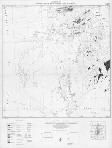
|
Geology of Mawson-Mulock Area, Victoria Land, Antarctica
|
Geology of Mawson-Mulock Area, Victoria Land, Antarctica
|
Geology of the Convoy Range area, southern Victoria Land, Antarctica View Map Details
Map ID - 8330
Published On - 1994 Scale - 1 : 50 000 Physical Size- -
No previews available
|
Geology of the Schirmacher-Wholthat region, central Dronning Maud Land, Antarctica View Map Details
Map ID - 8208
Published On - 1991 Scale - 1 : 250 000 Physical Size- -
No previews available
|
Showing 181 to 200 of 416 maps. On page 10 of 21, go to the Previous Page or Next Page