1:500 000 topographic map series
View All Map ListsShowing 21 to 40 of 51 maps. On page 2 of 3, go to the Previous Page or Next Page
SQ 50-51d Sabrina Coast to BANZARE Coast (Wilkes Land) View Map Details
Map ID - 14807
Published On - October-1962 Scale - 1 : 500 000 Physical Size- 55 x 67.5 cm Vertical Unit - Meters 
|
SQ 52-53b Dibble Iceberg Tongue View Map Details
Map ID - 14805
Published On - October-1962 Scale - 1 : 500 000 Physical Size- 55.4 x 67 cm Vertical Unit - Meters 
|
SQ 52-53c BANZARE Coast - Wilkes Coast (Wilkes Land) View Map Details
Map ID - 14809
Published On - September-1966 Scale - 1 : 500 000 Physical Size- 55 x 67 cm Vertical Unit - Meters 
|
SQ 52-53d Wilkes Land - Terre Adelie View Map Details
Map ID - 14808
Published On - October-1962 Scale - 1 : 500 000 Physical Size- 55.5 x 67 cm Vertical Unit - Meters 
|
SQ 54-55c Glacier du Francais (Terre Adelie) to Watt Bay (George V Land) View Map Details
Map ID - 14806
Published On - September-1966 Scale - 1 : 500 000 Physical Size- 55.5 x 66.5 cm Vertical Unit - Meters 
|
SQ 54-55d Watt Bay to Ninnis Glacier Tongue View Map Details
Map ID - 14804
Published On - January-1965 Scale - 1 : 500 000 Physical Size- 56 x 66.5 cm Vertical Unit - Meters 
|
SR 38-39a Dronning Maud Land - Enderby Land (western boundary of AAT) View Map Details
Map ID - 14784
Published On - August-1964 Scale - 1 : 500 000 Physical Size- 56 x 67.5 cm Vertical Unit - Meters 
|
SR 38-39b Mt Nils to Sandercock Nunataks - Enderby Land View Map Details
Map ID - 14785
Published On - November-1962 Scale - 1 : 500 000 Physical Size- 55 x 64 cm Vertical Unit - Meters 
|
SR 40-41a Dismal Mountains to Hansen Mountains - Kemp Land View Map Details
Map ID - 14780
Published On - October-1966 Scale - 1 : 500 000 Physical Size- 55.5 x 67 cm Vertical Unit - Meters 
|
SR 40-41b Mt Twintop to ANARE Nunataks - Mac. Robertson Land View Map Details
Map ID - 14788
Published On - August-1967 Scale - 1 : 500 000 Physical Size- 57.5 x 76.3 cm Vertical Unit - Meters 
|
SR 40-41d Prince Charles Mountains (west) View Map Details
Map ID - 14778
Published On - November-1967 Scale - 1 : 500 000 Physical Size- 57.5 x 76 cm Vertical Unit - Meters 
|
SR 41-42d Jetty Peninsula, Prince Charles Mountains, Mac. Robertson Land View Map Details
Map ID - 14764
Published On - February-1993 Scale - 1 : 500 000 Physical Size- 54 x 69 cm Vertical Unit - Meters 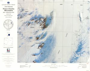
|
SR 42-43a Church Mountain to Mackenzie Bay - Mac. Robertson Land View Map Details
Map ID - 14786
Published On - April-1966 Scale - 1 : 500 000 Physical Size- 55.5 x 70.4 cm Vertical Unit - Meters 
|
SR 42-43b Amery Ice Shelf to Davis - Princess Elizabeth Land View Map Details
Map ID - 14794
Published On - October-1967 Scale - 1 : 500 000 Physical Size- 61.5 x 76.2 cm Vertical Unit - Meters 
|
SR 42-43c Charybdis Glacier to Gillock Island - Mac. Robertson Land View Map Details
Map ID - 14789
Published On - October-1966 Scale - 1 : 500 000 Physical Size- 55.5 x 61.5 cm Vertical Unit - Meters 
|
SR 42-43d Reinbolt Hills - Mac. Robertson Land - Princess Elizabeth Land View Map Details
Map ID - 14792
Published On - October-1962 Scale - 1 : 500 000 Physical Size- 55.5 x 67.5 cm Vertical Unit - Meters 
|
SR 44-45a Ingrid Christensen Coast - Princess Elizabeth Land View Map Details
Map ID - 14791
Published On - August-1964 Scale - 1 : 500 000 Physical Size- 55.5 x 68 cm Vertical Unit - Meters 
|
SR 48-49b View Map Details
Map ID - 14799
Published On - September-1966 Scale - 1 : 500 000 Physical Size- 55 x 67 cm Vertical Unit - Meters 
|
SR 48-49d ANARE Wilkes - Vostok Traverse 1962 View Map Details
Map ID - 14790
Published On - November-1963 Scale - 1 : 500 000 Physical Size- 57.5 x 73.5 cm Vertical Unit - Meters 
|
SR 54-55a Terre Adelie - George V Land View Map Details
Map ID - 14796
Published On - October-1962 Scale - 1 : 500 000 Physical Size- 55.5 x 67.7 cm Vertical Unit - Meters 
|
Showing 21 to 40 of 51 maps. On page 2 of 3, go to the Previous Page or Next Page