Win2 station information
Station identification
- Primary name
- Win2
Locality
Winston Lagoon ? Centre of bar separating small lagoon from Winston Lagoon
View place name details in the gazetteer
Type
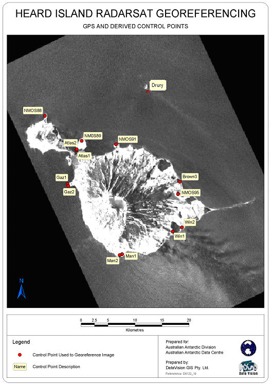
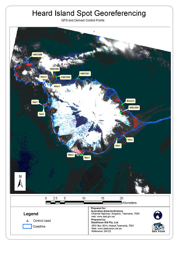
Heard Island Control
General
- Metadata
-
Heard_RadarSat_georef - Heard Island Radarsat Georeferencing Report, September 2002
- Date last visited
-
No visits or not recorded (if present then see metadata record)
- Date last maintained
- Location details
| Coordinates |
| Datum | Latitude | Longitude | Accuracy (m) | Order | Grid | Easting | Northing | Date released | Status |
| MSL |
-53° 9' 0.073900"
-53.15002052 |
73° 40' 34.948300"
73.67637453 |
|
|
43 |
411481.410 |
4110222.470 |
|
Current |
|
Orthometric
Heights |
| Datum | Height (m) | Accuracy (m) | Order | Date released | Status |
| MSL |
3 |
|
|
|
Current |
|
| Documents |
| Type | Name/Photo/Sketch thumbnail |
| Photo Identification |
View image
|
| Photo Identification |
View image
|
| Photo Identification |
View image
|
| Satellite Image |
No Image Available
Satellite Image Catalogue - View Reference 
Pixel on image - X=2966.6375 (residual -0.2375) Y=916.5902 (residual -0.2848)
|
| Satellite Image |
No Image Available
Satellite Image Catalogue - View Reference
Pixel on image - X=1731.6032 (residual 1.7282) Y=1236.7605 (residual -0.3645)
|
| Satellite Image |
Satellite Image Catalogue - Image Id 1977 not in the Satellite Image Catalogue.
|
| Satellite Image |
Satellite Image Catalogue - Image Id 1978 not in the Satellite Image Catalogue.
|
|
There are no nearby stations within 0.25 degrees of this station.