1961/62 V2 details
General information
- Season
- 1961/62
- Voyage
- V2
Ship
©AAD, Copyright Commonwealth of Australia 1961
- Catalogue id
- 4629C1
- Photographer
- Newton, Geoffrey (Geoff)
Leader
Voyage Leader
Phillip Garth Law
Deputy Voyage Leader
Hans A J Nielsen
Comments
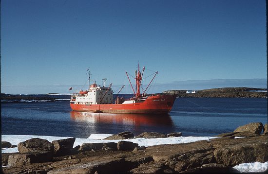
This voyage conducted the Wilkes changeover, inspected a site for a new station in the Wilkes area and made the first comprehensive survey of the Wilkes and Oates Land coasts, making it possible to map 480 km of coast and some 52,000 km2 of previously unknown territory. New landings were made at eight places. Mawson's Australasian Antarctic Expedition hut at Cape Denison, Dumont d'Urville and Macquarie Island was also visited. The RAAF Flight photographed 1600 km of poorly mapped coast and unknown inland terrain. Heights of the inland plateau were determined, astrofixes were obtained at seven points and geomagnetic observations were made at eight new sites. Of the 14,500 km travelled, 1300 were in ice. This was one of the most successful and profitable voyages of ANARE exploration to date.
Voyage Reports
No reports known - if you know of any, please contact the Data Centre and we can add them.
Schedule
Skeds not available for this voyage.Voyage track
Spatial bounds of voyage
No track has been constructed.
Voyage Data and Activities
Voyage activities
There are no data related activities recorded for this voyage.Weather
There is no weather data for this voyage.
Science Projects
Note - this page lists projects where there has been some requirements logged. This may include requests that are not directly associated with any science performed on the ship.
No Australian Antarctic Science Projects for voyage. See Current and Previous Projects for details on other projects.