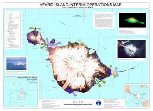
Map 12202: Heard Island Interim Operations Map, Including McDonald Islands
Map details
| Map Number | 12202 |
| Title | Heard Island Interim Operations Map, Including McDonald Islands |
| Edition | 1 (Out of Date) |
| Next Edition | [Next Edition : 2] |
| Scale | 1 : 50 000 |
| Publication date | June 1998 |
| Publisher |
Australian Antarctic Division (Australia)
|
| Spatial coverage |
( 73.0800° -52.8300°)
,
( 74.0000° -52.8300°)
,
( 74.0000° -53.2500°)
( 73.0800° -53.2500°) |
| Projection | Universal Transverse Mercator |
| Physical size | 83.5 x 115 cm A0 |
| Notes | single sided |
| Keywords | Heard , Island , Interim , Operations , Map , Including , Mcdonald , Islands , Laurens , Red , Azorella , Elephant , Spit , Atlas , Cove , Nullarbor , Abbotsmith , Lied , Gotley , Gazert , Pillar , Arkona , Labuan , Fiftyone , Lockyer , Winston , Doppler , Stephenson , Skua , SCARlet , Dovers , Round , Brown , Compton , Ealey , Bidlingmaier , Saddle , Downes , Baudissin , Big , Ben , Topographic |
Downloads
This is a digital map available for downloading.
Map Lists
No maps lists available.
Additional Information
| Horizontal datum | WGS84 |
| Vertical datum | MSL |
Preview