Map 12585: Macquarie Island approach paths (Helicopter Operations)
Map details
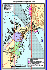
| Map Number | 12585 |
| Title | Macquarie Island approach paths (Helicopter Operations) |
| Edition | 2 |
| Scale | 1 : c5300 |
| Publication date | August 2000 |
| Publisher |
Australian Antarctic Division (Australia)
|
| Spatial coverage |
(158.9280° -54.4940°)
,
(158.9440° -54.4940°)
,
(158.9440° -54.5060°)
(158.9280° -54.5060°) |
| Projection | Universal Transverse Mercator |
| Physical size | 21 x 29.7 cm A4 |
| Notes | Used in the publication "Flight paths for helicopter operations in Australian Antarctic Territory". Edition 2 of the maps, August 2000. |
| Keywords | - |
Downloads
This is a digital map available for downloading.
Map Lists
This map belongs to the following lists. Use the link on the list to see all maps belonging to that list
Additional Information
Preview