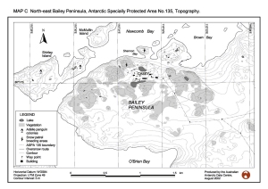
Map 12937: North-east Bailey Peninsula, Antarctic Specially Protected Area No. 135, Topography
Map details
| Map Number | 12937 |
| Title | North-east Bailey Peninsula, Antarctic Specially Protected Area No. 135, Topography |
| Edition | 1 (Out of Date) |
| Next Edition | [Next Edition : 2] |
| Scale | 1 : 15 400 |
| Publication date | August 2002 |
| Publisher |
Australian Antarctic Division (Australia)
|
| Spatial coverage |
(110.4667° -66.2667°)
,
(110.5667° -66.2667°)
,
(110.5667° -66.3000°)
(110.4667° -66.3000°) |
| Projection | Universal Transverse Mercator |
| Physical size | 18.5 x 28 cm |
| Notes | Map C produced for the Draft Management Plan of North-east Bailey Peninsula |
| Keywords | Bailey Peninsula , ASPA 135 , Protected Areas , Shirley Island , Mcmullin Island |
Downloads
This is a digital map available for downloading.
Map Lists
No maps lists available.
Additional Information
| Horizontal datum | WGS84 |
| Vertical datum | Mean Sea Level |
| Nomenclature | Australian Antarctic Names Gazetteer |
Preview