Map 13004: Amery Region
Map details
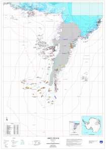
| Map Number | 13004 |
| Title | Amery Region |
| Edition | 2 |
| Previous edition | [Previous edition : 1] |
| Scale | 1 : 1 000 000 |
| Publication date | May 2003 |
| Publisher |
Australian Antarctic Division (Australia)
|
| Spatial coverage |
( 56.4000° -66.9000°)
,
( 79.0000° -66.9000°)
,
( 79.0000° -76.3000°)
( 56.4000° -76.3000°) |
| Projection | Mercator |
| Physical size | 117 x 82.5 cm |
| Keywords | Amery , Lambert , Prince , Charles , Mountain , Prydz , Topographic |
Downloads
This is a digital map available for downloading.
Map Lists
This map belongs to the following lists. Use the link on the list to see all maps belonging to that list
Additional Information
| Horizontal datum | WGS84 |
| Vertical datum | Mean sea level |
| Nomenclature | Australian Antarctic Gazetteer |
Preview