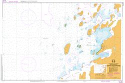
Map 13018: AUS 602 Approaches to Davis Anchorage
Map details
| Map Number | 13018 |
| Title | AUS 602 Approaches to Davis Anchorage |
| Edition | - |
| Scale | 1 : 12 500 |
| Publication date | 31 May 2019 |
| Publisher |
Hydrographic Service, Department of the Navy, Wollongong (Australia)
|
| Spatial coverage |
( 77.7000° -68.5333°)
,
( 78.0167° -68.5333°)
,
( 78.0167° -68.6083°)
( 77.7000° -68.6083°) |
| Projection | Transverse Mercator |
| Physical size | 75 x 110 cm |
| Notes | First edition published Nov 1989. |
| Reference | AUS 602, Int 9032 |
| Keywords | Aus 602 , Int 9032 , Davis Anchorage , Heidemann Bay , Donskiye Islands , Gardner Island , Anchorage Island , Hobby Rocks , Prydz Bay , Bluff Island , Trigwell Island , Flutter Island , Magnetic Island , Turner Island , Nautical , Chart |
Downloads
Map Lists
This map belongs to the following lists. Use the link on the list to see all maps belonging to that list
Additional Information
| Horizontal datum | WGS84 |
| Vertical datum | Mean Sea Level |
Preview