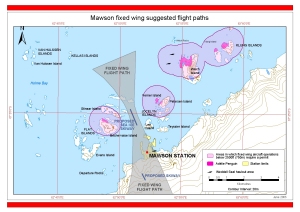
Map 13027: Mawson fixed wing suggested flight paths
Map details
| Map Number | 13027 |
| Title | Mawson fixed wing suggested flight paths |
| Edition | 1 (Out of Date) |
| Next Edition | [Next Edition : 2] |
| Scale | 1 : 58 000 |
| Publication date | June 2003 |
| Publisher |
Australian Antarctic Division (Australia)
|
| Spatial coverage |
( 62.7167° -67.0000°)
,
( 63.0833° -67.0000°)
,
( 63.0833° -68.0000°)
( 62.7167° -68.0000°) |
| Projection | Universal Transverse Mercator |
| Physical size | - |
| Keywords | Mawson Station , Fixed Wing Flight Paths , Van Hulssen Islands , Kellas Islands , Flat Islands , Stinear Island , Bechervaise Island , Evans Island , Departure Rocks , Lee Island , Teyssier Island , Petersen Island , Verner Island , Jocelyn Islands , Welch Island , Klung Islands , Skiway |
Downloads
This is a digital map available for downloading.
Map Lists
No maps lists available.
Additional Information
| Horizontal datum | WGS84 |
| Vertical datum | Mean Sea Level |
| Nomenclature | Australian Antarctic Gazetteer |
Preview