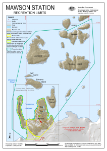
Map 13391: Mawson Station: Recreation Limits
Map details
| Map Number | 13391 |
| Title | Mawson Station: Recreation Limits |
| Edition | 1 (Out of Date) |
| Next Edition | [Next Edition : 2] |
| Scale | 1 : 11 500 |
| Publication date | December 2007 |
| Publisher |
Australian Antarctic Division (Australia)
|
| Spatial coverage |
( 62.8572° -67.5819°)
,
( 62.9067° -67.5819°)
,
( 62.9067° -67.6074°)
( 62.8572° -67.6074°) |
| Projection | Universal Transverse Mercator |
| Physical size | 29.7 x 21 cm A4 |
| Keywords | Mawson Station , Recreation Limits , Hump Island , Entrance Island , Dyer Island , Lee Island , Teyssier Island , Jocelyn Islands , West Arm |
Downloads
This is a digital map available for downloading.
Map Lists
No maps lists available.
Additional Information
| Horizontal datum | WGS84 |
| Vertical datum | Mean sea level |
Preview