Map 13479: Cape Adare and Cape Hallett : Cape Adare
Map details
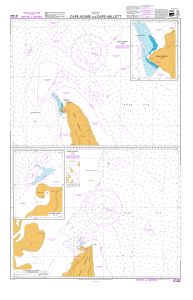
| Map Number | 13479 |
| Title | Cape Adare and Cape Hallett : Cape Adare |
| Edition | 2 |
| Scale | 1 : 50 000 |
| Publication date | August 2006 |
| Publisher |
Land Information New Zealand (New Zealand)
|
| Spatial coverage |
(169.9417° -71.2917°)
,
(170.8000° -71.2917°)
,
(170.8000° -71.3667°)
(169.9417° -71.3667°) |
| Projection | Mercator |
| Physical size | 53 x 64 cm |
| Notes |
Inset: Ridley Beach (1:15,000) See also Mapcat ref. 13404 "Cape Hallett" published on same sheet 1st ed. published Jan. 2003 |
| Reference | INT 9006 NZ 14906 |
| Keywords | Cape Adare , Adare Peninsula , Ridley Beach , ASPA 159 , Hanson Peak , Seal Point , Robertson Bay , Nautical , Chart |
Downloads
Map Lists
This map belongs to the following lists. Use the link on the list to see all maps belonging to that list
Additional Information
| Horizontal datum | WGS84 |
Preview