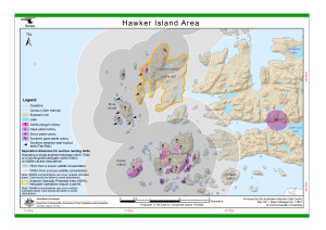
Map 13891: Hawker Island Area (Helicopter Operations)
Map details
| Map Number | 13891 |
| Title | Hawker Island Area (Helicopter Operations) |
| Edition | 3 (Out of Date) |
| Previous edition | [Previous edition : 2] |
| Next Edition | [Next Edition : 4] |
| Scale | 1 : 37 000 |
| Publication date | May 2011 |
| Publisher | - |
| Spatial coverage |
( 77.7367° -68.6229°)
,
( 77.9775° -68.6229°)
,
( 77.9775° -68.6727°)
( 77.7367° -68.6727°) |
| Projection | Universal Transverse Mercator |
| Physical size | 21 x 29.7 cm A4 |
| Notes | Pintado Island is labelled incorrectly on this map. See map 14593 for the location of this island. |
| Keywords | ASPA |
Downloads
This is a digital map available for downloading.
Map Lists
No maps lists available.
Additional Information
| Horizontal datum | WGS84 |
| Vertical datum | Mean sea level |
| Vertical unit | Metres |
| Nomenclature | Australian Antarctic Gazetteer |
Preview