Map 14296: Davis: Recreation Limits
Map details
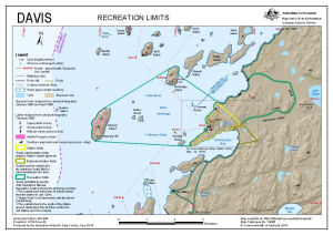
| Map Number | 14296 |
| Title | Davis: Recreation Limits |
| Edition | 4 (Out of Date) |
| Previous edition | [Previous edition : 3] |
| Next Edition | [Next Edition : 5] |
| Scale | 1 : 40 000 |
| Publication date | June 2014 |
| Publisher |
Australian Antarctic Division (Australia)
|
| Spatial coverage |
( 77.7939° -68.5458°)
,
( 78.0639° -68.5458°)
,
( 78.0639° -68.6064°)
( 77.7939° -68.6064°) |
| Projection | Universal Transverse Mercator |
| Physical size | 21 x 29.7 cm A4 |
| Keywords | Ski Landing Area , Lake Dingle , Heidemann Valley , Heidemann Bay , Ripple Lake , Law Cairn , Gardner Island , Anchorage Island , Trigwell Island , Flutter Island , Warriner Island |
Downloads
This is a digital map available for downloading.
Map Lists
No maps lists available.
Additional Information
| Horizontal datum | WGS84 |
| Vertical datum | Mean sea level |
| Vertical unit | Metres |
| Nomenclature | Australian Antarctic Gazetteer |
Preview