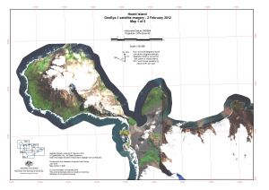
Map 14520: Heard Island, GeoEye satellite imagery - 2 February 2012, Map 1 of 5
Map details
| Map Number | 14520 |
| Title | Heard Island, GeoEye satellite imagery - 2 February 2012, Map 1 of 5 |
| Edition | 1 |
| Scale | 1 : 50 000 |
| Publication date | July 2016 |
| Publisher |
Australian Antarctic Division (Australia)
|
| Spatial coverage |
( 73.2333° -52.9500°)
,
( 73.5167° -52.9500°)
,
( 73.5167° -53.0667°)
( 73.2333° -53.0667°) |
| Projection | Universal Transverse Mercator |
| Physical size | - |
| Keywords | Satellite Imagery |
Downloads
This is a digital map available for downloading.
Map Lists
This map belongs to the following lists. Use the link on the list to see all maps belonging to that list
Additional Information
| Horizontal datum | WGS84 |
Preview