Map 15784: Vestfold Hills
Map details
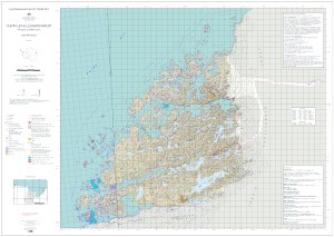
| Map Number | 15784 |
| Title | Vestfold Hills |
| Edition | 3 |
| Previous edition | [Previous edition : 2] |
| Scale | 1 : 50 000 |
| Publication date | August 2022 |
| Publisher |
Australian Antarctic Division (Australia)
|
| Spatial coverage |
( 77.7778° -68.3400°)
,
( 78.8764° -68.3400°)
,
( 78.8764° -68.6878°)
( 77.7778° -68.6878°) |
| Projection | Universal Transverse Mercator |
| Physical size | 82.8 x 117.7 cm A0 |
| Keywords | Broad , Peninsula , Long , Mule , Sorsdal , Sørsdal , Crooked , Ellis , Tryne |
Downloads
This is a digital map available for downloading.
Map Lists
This map belongs to the following lists. Use the link on the list to see all maps belonging to that list
Additional Information
| Horizontal datum | WGS84 |
| Vertical datum | Mean sea level |
| Nomenclature | Australian Antarctic Gazetteer |
Preview