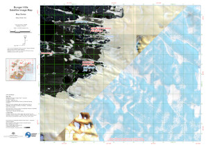
Map 16043: Bunger Hills Satellite Image Map - Map Series - Map Sheet: B3
Map details
| Map Number | 16043 |
| Title | Bunger Hills Satellite Image Map - Map Series - Map Sheet: B3 |
| Edition | 1 |
| Scale | 1 : 50 000 |
| Publication date | November 2023 |
| Publisher |
Australian Antarctic Division (Australia)
|
| Spatial coverage |
(101.1461° -66.0888°)
,
(101.4937° -66.0888°)
,
(101.4937° -66.2170°)
(101.1461° -66.2170°) |
| Projection | UTM Zone 47 |
| Physical size | 29.7 x 42 cm A3 |
| Notes |
Map Sheets in series: 16038 - Sheet A1 16039 - Sheet A2 16040 - Sheet A3 16041 - Sheet B1 16042 - Sheet B2 16043 - Sheet B3 16044 - Sheet C1 16045 - Sheet C2 |
| Keywords | - |
Downloads
This is a digital map available for downloading.
Map Lists
This map belongs to the following lists. Use the link on the list to see all maps belonging to that list
Additional Information
| Horizontal datum | WGS84 |
| Vertical unit | Metres |
Preview