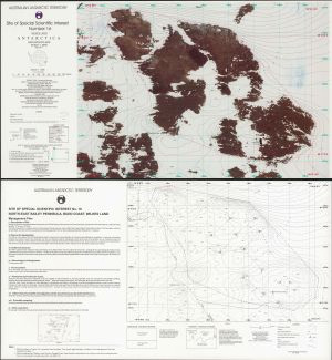
Map 5: Site of Special Scientific Interest Number 16, Wilkes Land, Antarctica
Map details
| Map Number | 5 |
| Title | Site of Special Scientific Interest Number 16, Wilkes Land, Antarctica |
| Edition | 1 |
| Scale | 1 : 2000 |
| Publication date | December 1996 |
| Publisher |
Australian Antarctic Division (Australia)
|
| Spatial coverage |
(110.5330° -66.2750°)
,
(110.5510° -66.2750°)
,
(110.5510° -66.2840°)
(110.5330° -66.2840°) |
| Projection | Transverse Mercator |
| Physical size | 35 x 65.5 cm |
| Notes | Double sided. |
| Reference | L45 |
| Keywords | SSSI , No.16 , Survey Marks , Bailey Peninsula |
Downloads
This is a hard copy map that has been scanned. See information about obtaining copies of hard copy maps.
Map Lists
This map belongs to the following lists. Use the link on the list to see all maps belonging to that list
Additional Information
| Horizontal datum | WGS84 |
| Vertical datum | msl |
| Nomenclature | Antarctic Names Committee of Australia |
Preview