1:250 000 topographic maps
View All Map ListsThe map below shows the extents of each map in this list Alt+Shift+Drag to rotate the map
Showing 21 to 40 of 49 maps. On page 2 of 3, go to the Previous Page or Next Page
Mount Rabot View Map Details
Map ID - 3596
Published On - January-1988 Scale - 1 : 250 000 Physical Size- 66 x 76 cm 
|
Mount Soza View Map Details
Map ID - 3552
Published On - 1989 Scale - 1 : 250 000 Physical Size- 66 x 76 cm 
|
Ob' Bay View Map Details
Map ID - 3605
Published On - 1970 Scale - 1 : 250 000 Physical Size- 66.5 x 61 cm 
|
OrlÈans Strait and Detroit Plateau View Map Details
Map ID - 15302
Published On - 2017 Scale - 1 : 250 000 Physical Size- 89 x 75 cm Vertical Unit - Meters 
|
Pomerantz Tableland View Map Details
Map ID - 3611
Published On - 1970 Scale - 1 : 250 000 Physical Size- 66 x 61 cm 
|
Sequence Hills View Map Details
Map ID - 3623
Published On - 1969 Scale - 1 : 250 000 Physical Size- 68 x 81 cm 
|
Sheet SQ 38-39/14, Tange Promontory, Australian Antarctic Territory, Enderby Land [SQ 37-38/16] View Map Details
Map ID - 107
Published On - August-1962 Scale - 1 : 250 000 Physical Size- 69.5 x 64.5 cm ![Sheet SQ 38-39/14, Tange Promontory, Australian Antarctic Territory, Enderby Land [SQ 37-38/16]](/database/mapcat/250k/SQ38-39_14_1962_250k_107_thumb.jpg)
|
Sheet SQ 38-39/15, Simpson Peak, Australian Antarctic Territory, Enderby Land [SQ 39-40/13] View Map Details
Map ID - 104
Published On - August-1962 Scale - 1 : 250 000 Physical Size- 69.5 x 65 cm ![Sheet SQ 38-39/15, Simpson Peak, Australian Antarctic Territory, Enderby Land [SQ 39-40/13]](/database/mapcat/250k/SQ38-39_15_1962_250k_104_thumb.jpg)
|
Sheet SQ 38-39/16, McLeod Nunataks, Australian Antarctic Territory, Enderby Land [SQ 39-40/14] View Map Details
Map ID - 90
Published On - March-1964 Scale - 1 : 250 000 Physical Size- 67 x 67 cm ![Sheet SQ 38-39/16, McLeod Nunataks, Australian Antarctic Territory, Enderby Land [SQ 39-40/14]](/database/mapcat/250k/SQ38-39_16_1964_250k_90_thumb.jpg)
|
Sheet SQ 40-41/10, Oygarden Group, Australian Antarctic Territory, Kemp Land [SQ 39-40/12] View Map Details
Map ID - 99
Published On - May-1966 Scale - 1 : 250 000 Physical Size- 67 x 67 cm ![Sheet SQ 40-41/10, Oygarden Group, Australian Antarctic Territory, Kemp Land [SQ 39-40/12]](/database/mapcat/250k/SQ40-41_10_1966_250k_99_thumb.jpg)
|
Sheet SQ 40-41/14, Law Promontory, Australian Antarctic Territory, Kemp Land [SQ 39-40/16] View Map Details
Map ID - 86
Published On - May-1966 Scale - 1 : 250 000 Physical Size- 67 x 67 cm ![Sheet SQ 40-41/14, Law Promontory, Australian Antarctic Territory, Kemp Land [SQ 39-40/16]](/database/mapcat/250k/SQ40-41_14_1966_250k_86_thumb.jpg)
|
Sheet SQ 41-42/15, Scullin Monolith, Australian Antarctic Territory, Mac. Robertson Land View Map Details
Map ID - 103
Published On - March-1970 Scale - 1 : 250 000 Physical Size- 65 x 60.5 cm 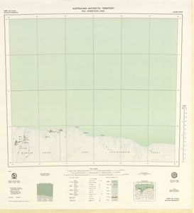
|
Sheet SQ 49-50/9, Vincennes Bay, Australian Antarctic Territory, Wilkes Land View Map Details
Map ID - 108
Published On - March-1969 Scale - 1 : 250 000 Physical Size- 67 x 67 cm 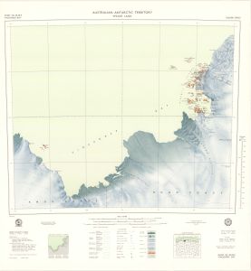
|
Sheet SR 38-39/3, Nye Mountains, Australian Antarctic Territory, Enderby Land [SR 39-40/1] View Map Details
Map ID - 97
Published On - June-1966 Scale - 1 : 250 000 Physical Size- 67 x 67 cm ![Sheet SR 38-39/3, Nye Mountains, Australian Antarctic Territory, Enderby Land [SR 39-40/1]](/database/mapcat/250k/SR38-39_3_1966_250k_97_thumb.jpg)
|
Sheet SR 40-41/2, Hansen Mountains, Australian Antarctic Territory, Kemp Land [SR 39-40/4] View Map Details
Map ID - 84
Published On - June-1966 Scale - 1 : 250 000 Physical Size- 67 x 67 cm ![Sheet SR 40-41/2, Hansen Mountains, Australian Antarctic Territory, Kemp Land [SR 39-40/4]](/database/mapcat/250k/SR40-41_2_1966_250k_84_thumb.jpg)
|
Sheet SR 41-42/10, Crohn Massif, Australian Antarctic Territory, Mac. Robertson Land, View Map Details
Map ID - 81
Published On - March-1970 Scale - 1 : 250 000 Physical Size- 65 x 61 cm 
|
Sheet SR 41-42/3, Church Mountain, Australian Antarctic Territory, Mac. Robertson Land, View Map Details
Map ID - 80
Published On - March-1970 Scale - 1 : 250 000 Physical Size- 65 x 60.5 cm 
|
Sheet SR 41-42/6, Stinear Nunataks, Australian Antarctic Territory, Mac. Robertson Land View Map Details
Map ID - 106
Published On - May-1969 Scale - 1 : 250 000 Physical Size- 66 x 59 cm 
|
Sheets SQ 38-39/12 & Part 8, Mount Codrington & Proclamation Island, Australian Antarctic Territory, Enderby Land [SQ 39-40/10 & Part 6] View Map Details
Map ID - 92
Published On - March-1964 Scale - 1 : 250 000 Physical Size- 71 x 67 cm ![Sheets SQ 38-39/12 & Part 8, Mount Codrington & Proclamation Island, Australian Antarctic Territory, Enderby Land [SQ 39-40/10 & Part 6]](/database/mapcat/250k/SQ38-39_12_&_Part_8_1964_250k_92_thumb.jpg)
|
Sheets SQ 40-41/13 & Part SR 40-41/1, Rayner Peak & Dismal Mountains, Australian Antarctic Territory, Enderby Land - Kemp Land [SQ 39-40/15 & Part SR 39-40/3] View Map Details
Map ID - 101
Published On - October-1967 Scale - 1 : 250 000 Physical Size- 71 x 67 cm ![Sheets SQ 40-41/13 & Part SR 40-41/1, Rayner Peak & Dismal Mountains, Australian Antarctic Territory, Enderby Land - Kemp Land [SQ 39-40/15 & Part SR 39-40/3]](/database/mapcat/250k/SQ40-41_13_&_Part_SR40-41_1_1967_250k_101_thumb.jpg)
|
Showing 21 to 40 of 49 maps. On page 2 of 3, go to the Previous Page or Next Page