Mawson Coast
View All Map ListsMaps of the Mawson Coast which extends from 60°E to 66°53'E
Showing all 9 maps.
Adelie penguin presence in the Robinson Group View Map Details
Map ID - 13278
Published On - May-2006 Scale - 1 : 300 000 Physical Size- 21 x 29.7 cm A4 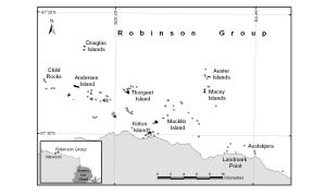
|
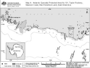
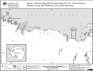
Antarctic Specially Protected Area No. 101
|
Antarctic Specially Protected Area No. 101
|
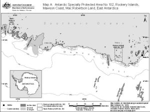
Antarctic Specially Protected Area No. 102
|
Mawson Coast [Black and white] View Map Details
Map ID - 13156
Published On - June-2005 Scale - 1 : 416 724 Physical Size- 11.9 x 19.4 cm ![Mawson Coast [Black and white]](/database/mapcat/mawson_coast/mawson_coast_bw_A5_thumb.jpg)
|
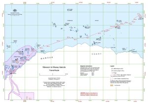
Mawson to Auster Rookery View Map Details
Map ID - 13458
Published On - January-2008 Scale - 1 : 130 000 Physical Size- 29.7 x 42 cm A3 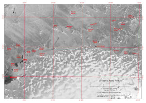
|
Mawson to Colbeck Archipelago
|
Mawson to Macey Islands
|
Mawson to Taylor Glacier View Map Details
Map ID - 13459
Published On - January-2008 Scale - 1 : 250 000 Physical Size- 29.7 x 42 cm A3 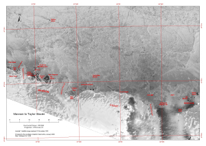
|

Showing all 9 maps.