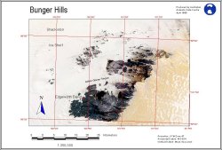
Map 11226: Bunger Hills Satellite Image Map
Map details
| Map Number | 11226 |
| Title | Bunger Hills Satellite Image Map |
| Edition | 1 |
| Scale | 1 : 350 000 |
| Publication date | June 1999 |
| Publisher | - |
| Spatial coverage |
(100.3000° -65.5000°)
,
(101.6000° -65.5000°)
,
(101.6000° -66.3000°)
(100.3000° -66.3000°) |
| Projection | Universal Transverse Mercator |
| Physical size | 70 x 90 cm A4 |
| Keywords | Satellite Imagery |
Downloads
This is a digital map available for downloading.
Map Lists
This map belongs to the following lists. Use the link on the list to see all maps belonging to that list
Additional Information
Preview