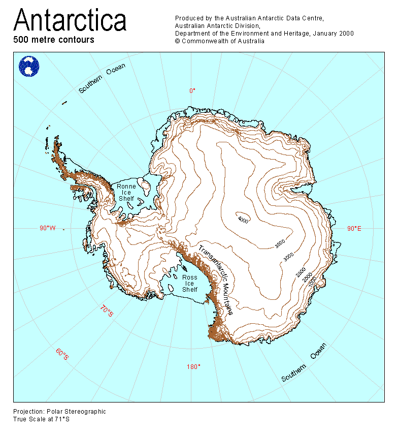
Map 12149: Antarctica : 500 metre contours
Map details
| Map Number | 12149 |
| Title | Antarctica : 500 metre contours |
| Edition | 1 (Out of Date) |
| Next Edition | [Next Edition : 2] |
| Scale | Not Entered |
| Publication date | January 2000 |
| Publisher | - |
| Spatial coverage |
(-180.0000° -40.0000°)
,
(180.0000° -40.0000°)
,
(180.0000° -90.0000°)
(-180.0000° -90.0000°) |
| Projection | Polar Stereographic |
| Physical size | 29.7 x 21 cm A4 |
| Keywords | 500 Metre Contours , Topographic |
Downloads
This is a digital map available for downloading.
Map Lists
No maps lists available.
Additional Information
Preview