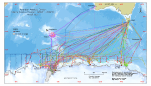
Map 13869: Australian Antarctic Division Marine Science Voyages 1980/81 - 2009/10
Voyage tracks
Map details
| Map Number | 13869 |
| Title | Australian Antarctic Division Marine Science Voyages 1980/81 - 2009/10 Voyage tracks |
| Edition | 1 |
| Scale | 1 : 27 000 000 |
| Publication date | September 2010 |
| Publisher | - |
| Spatial coverage |
( 29.0333° -29.0667°)
,
(164.0333° -29.0667°)
,
(164.0333° -72.6167°)
( 29.0333° -72.6167°) |
| Projection | Mercator |
| Physical size | 16 x 28 cm |
| Notes |
Search for information about the voyages The coastline of Antarctica is from the Antarctic Digital Database version 5 © Scientific Committee on Antarctic Research 1993-2006. The bathymetry is from "Centenary Edition of the GEBCO Digital Atlas", 2003, published on behalf of the Intergovernmental Oceanographic Commission and the International Hydrographic Organization as part of the General Bathymetric Chart of the Oceans; British Oceanographic Data Centre, Liverpool. |
| Keywords | Australian Antarctic Program , Ship Tracks |
Downloads
This is a digital map available for downloading.
Map Lists
This map belongs to the following lists. Use the link on the list to see all maps belonging to that list
Additional Information
Preview