Map 14599: Mawson Ski Landing Areas
Map details
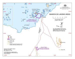
| Map Number | 14599 |
| Title | Mawson Ski Landing Areas |
| Edition | 5 |
| Previous edition | [Previous edition : 4] |
| Scale | 1 : 120 000 |
| Publication date | July 2017 |
| Publisher |
Australian Antarctic Division (Australia)
|
| Spatial coverage |
( 62.4825° -67.5503°)
,
( 63.1697° -67.5503°)
,
( 63.1697° -67.7550°)
( 62.4825° -67.7550°) |
| Projection | Universal Transverse Mercator |
| Physical size | 19 x 24.3 cm |
| Keywords | Runway , Sea Ice , Skiway , Holme Bay , Mt Henderson |
Downloads
This is a digital map available for downloading.
Map Lists
This map belongs to the following lists. Use the link on the list to see all maps belonging to that list
Additional Information
| Horizontal datum | WGS84 |
Preview