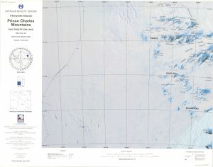
Map 14720: Charybdis Glacier, Prince Charles Mountains, Mac. Robertson Land
Map details
| Map Number | 14720 |
| Title | Charybdis Glacier, Prince Charles Mountains, Mac. Robertson Land |
| Edition | Provisional (Out of Date) |
| Next Edition | [Next Edition : 1] |
| Scale | 1 : 500 000 |
| Publication date | September 1991 |
| Publisher | - |
| Spatial coverage |
( 59.5000° -69.9167°)
,
( 66.5000° -69.9167°)
,
( 67.0000° -72.0333°)
( 59.0000° -72.0333°) |
| Projection | Lambert Conformal Conic |
| Physical size | 54 x 69 cm |
| Reference |
SR 41-42c Cat. No: M* in ANARE Catalogue 1997 |
| Keywords | Charybdis , glacier , Prince Charles Mountains , Mac. Robertson , Land , Anare nunataks , Athos Range , Dovers , Scylla Glacier , Porthos Range , Aramis Range , Sr41-42C , Sr41/42/C , Satellite imagery |
Downloads
This is a hard copy map that has been scanned. See information about obtaining copies of hard copy maps.
Map Lists
No maps lists available.
Additional Information
Preview