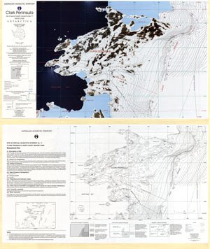
Map 4: Clark Peninsula, Site of Special Scientific Interest no.17
Map details
| Map Number | 4 |
| Title | Clark Peninsula, Site of Special Scientific Interest no.17 |
| Edition | 1 |
| Scale | 1 : 10 000 |
| Publication date | December 1996 |
| Publisher |
Australian Antarctic Division (Australia)
|
| Spatial coverage |
(110.5224° -66.2409°)
,
(110.6657° -66.2409°)
,
(110.6657° -66.2776°)
(110.5224° -66.2776°) |
| Projection | Transverse Mercator |
| Physical size | 49 x 84.5 cm |
| Notes | Double sided. |
| Reference | L46 |
| Keywords | Site Of Special Scientific Interest No. 17 , Sssi 17 , Survey Marks |
Downloads
This is a hard copy map that has been scanned. See information about obtaining copies of hard copy maps.
- Orthophoto map (PDF)
- Topographic map (PDF)
- Orthophoto map (LZW compressed TIFF)
- Topographic map (LZW compressed TIFF)
Map Lists
This map belongs to the following lists. Use the link on the list to see all maps belonging to that list
- Windmill Islands / Casey - extended list
- Orthophoto maps
- Antarctic Specially Protected Areas and Antarctic Specially Managed Areas maps
Additional Information
| Horizontal datum | WGS84 |
| Vertical datum | msl |
| Nomenclature | Antarctic Names Committee of Australia |
Preview