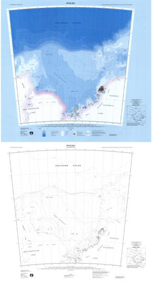
Map 7: Prydz Bay
Map details
| Map Number | 7 |
| Title | Prydz Bay |
| Edition | 3 |
| Scale | 1 : 1 000 000 |
| Publication date | September 1997 |
| Publisher |
Australian Antarctic Division (Australia)
|
| Spatial coverage |
( 68.0000° -65.0000°)
,
( 81.0000° -65.0000°)
,
( 81.0000° -70.0000°)
( 68.0000° -70.0000°) |
| Projection | Lambert Conformal Conic |
| Physical size | 70 x 75 cm |
| Notes | This map is a double sided hard copy map. The front shows the bathymetric map. The back shows sounding lines from which the bathymetric contours were derived. 1:1,000,000 bathymetric map series. International map of the world part sheets SQ 41-42, SQ 43-44, SR 41-42, SR 43-44. |
| Reference |
SQ 41-42, SQ43-44, SR41-42, SR43-44 Cat.No:S24 in 'ANARE Catalogue of Maps and Hydrographic Charts 1997' |
| Keywords | Southern , Ocean , Prydz Channel , Amery Depression , Ingrid Christensen Coast , Princess Elizabeth Land , Mac. Robertson Land , Mac.Robertson Land , Lars Christensen Coast , Foley Promontory , Landon Promontory , Vestfold Hills , Sorsdal Glacier , Rauer Group , Ranvik Bay , Svenner Islands , Brattstrand Bluffs , Larsemann Hills , Sansom Island , Statler Hills , Lichen Island , Cleft Island , Bolingen Islands , Sandefjord Bay , Dubinin Trough , Four Ladies Bank , Sq 41-42 , Sq43-44 , Sr41-42 , Sr43-44 , Sq 41-42 Sq43-44 Sr41-42 Sr43-44 , Ship Tracks , Bathymetry |
Downloads
This is a hard copy map that has been scanned. See information about obtaining copies of hard copy maps.
- Bathymetric map (LZW compressed TIFF)
- Sounding lines (LZW compressed TIFF)
- Bathymetric map (PDF)
- Sounding lines (PDF)
Map Lists
This map belongs to the following lists. Use the link on the list to see all maps belonging to that list
Additional Information
| Horizontal datum | WGS84 |
| Vertical datum | MSL |
| Nomenclature | Australian Antarctic Gazetteer |
Preview