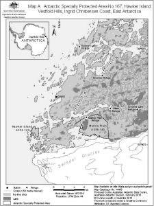
Antarctic Specially Protected Area No 167
Hawker Island, Vestfold Hills, Ingrid Christensen Coast, East Antarctica
Map A
View Map Details
Map ID - 14499
Published On -
February-2016
Scale -
1 : 200 000
Physical Size-
20 x 15 cm
|
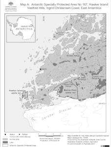
Antarctic Specially Protected Area No 167
Hawker Island, Vestfold Hills, Ingrid Christensen Coast, East Antarctica
Map A
View Map Details
Map ID - 15406
Published On -
April-2021
Scale -
1 : 200 000
Physical Size-
20 x 15 cm
|
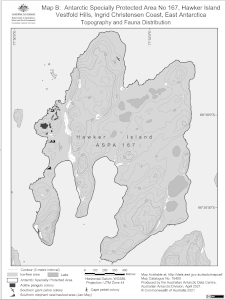
Antarctic Specially Protected Area No 167
Hawker Island, Vestfold Hills, Ingrid Christensen Coast, East Antarctica
Map B: Topography and Fauna Distribution
View Map Details
Map ID - 15405
Published On -
April-2021
Scale -
1 : 15 000
Physical Size-
19.8 x 14.7 cm
|
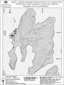
Antarctic Specially Protected Area No 167
Hawker Island, Vestfold Hills, Ingrid Christensen Coast, East Antarctica
Map B: Topography and Fauna Distribution
View Map Details
Map ID - 14500
Published On -
February-2016
Scale -
1 : 15 000
Physical Size-
19.8 x 14.7 cm
|
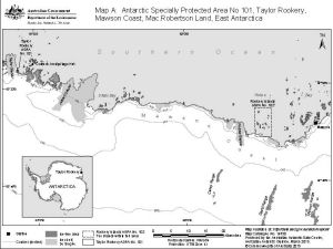
Antarctic Specially Protected Area No. 101
Taylor Rookery, Mawson Coast, Mac.Robertson Land, East Antarctica
Map A
View Map Details
Map ID - 15420
Published On -
April-2021
Scale -
1 : 475 000
Physical Size-
15 x 20 cm
|
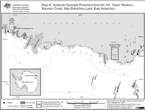
Antarctic Specially Protected Area No. 101
Taylor Rookery, Mawson Coast, Mac.Robertson Land, East Antarctica
Map A
View Map Details
Map ID - 14350
Published On -
March-2015
Scale -
1 : 475 000
Physical Size-
15 x 20 cm
|
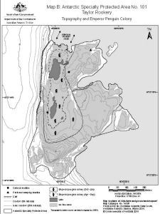
Antarctic Specially Protected Area No. 101
Taylor Rookery
Map B: Topography and Emperor Penguin Colony
View Map Details
Map ID - 14338
Published On -
March-2015
Scale -
1 : 5000
Physical Size-
20 x 15 cm
|
Antarctic Specially Protected Area No. 101
Taylor Rookery
Map B: Topography and Emperor Penguin Colony
View Map Details
Map ID - 15419
Published On -
April-2021
Scale -
1 : 5000
Physical Size-
20 x 15 cm
|
Antarctic Specially Protected Area No. 101
Taylor Rookery
Map C: Helicopter Approach and Landing site
View Map Details
Map ID - 15421
Published On -
April-2021
Scale -
1 : 7500
Physical Size-
15 x 20 cm
|
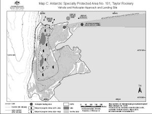
Antarctic Specially Protected Area No. 101
Taylor Rookery
Map C: Helicopter Approach and Landing site
View Map Details
Map ID - 14339
Published On -
March-2015
Scale -
1 : 7500
Physical Size-
15 x 20 cm
|
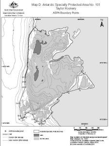
Antarctic Specially Protected Area No. 101
Taylor Rookery
Map D: ASPA boundary points
View Map Details
Map ID - 15422
Published On -
April-2021
Scale -
1 : 7500
Physical Size-
15 x 20 cm
|
Antarctic Specially Protected Area No. 101
Taylor Rookery
Map D: ASPA boundary points
View Map Details
Map ID - 14351
Published On -
February-2015
Scale -
1 : 7500
Physical Size-
15 x 20 cm
|
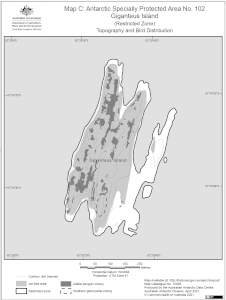
Antarctic Specially Protected Area No. 102
Giganteus Island (Restricted Zone)
Map C: Topography and Bird Distribution
View Map Details
Map ID - 15409
Published On -
April-2021
Scale -
1 : 5000
Physical Size-
20 x 15 cm
Vertical Unit -
Meters
|
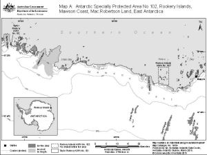
Antarctic Specially Protected Area No. 102
Rookery Islands, Mawson Coast, Mac.Robertson Land, East Antarctica
Map A
View Map Details
Map ID - 14354
Published On -
1-Mar-2015 00:00
Scale -
1 : 475 000
Physical Size-
15 x 20 cm
|
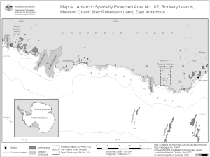
Antarctic Specially Protected Area No. 102
Rookery Islands, Mawson Coast, Mac.Robertson Land, East Antarctica
Map A
View Map Details
Map ID - 15407
Published On -
April-2021
Scale -
1 : 475 000
Physical Size-
15 x 20 cm
|
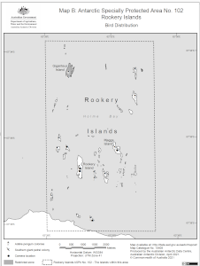
Antarctic Specially Protected Area No. 102
Rookery Islands
Map B : Bird Distribution
View Map Details
Map ID - 15408
Published On -
April-2021
Scale -
1 : 57 000
Physical Size-
20 x 15 cm
|
Antarctic Specially Protected Area No. 103
Ardery and Odbert Islands, Budd Coast, Wikes Land, East Antarctica
Map A
View Map Details
Map ID - 15410
Published On -
April-2021
Scale -
1 : 230 000
Physical Size-
20 x 15 cm
|
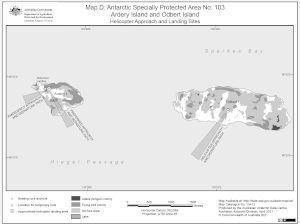
Antarctic Specially Protected Area No. 103
Ardery Island and Odbert Island
Map D: Helicopter Approach and Landing Sites
View Map Details
Map ID - 15413
Published On -
April-2021
Scale -
1 : 35 000
Physical Size-
15 x 20 cm
|
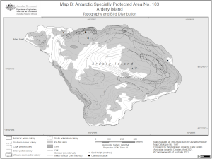
Antarctic Specially Protected Area No. 103
Ardery Island
Map B: Topography and Bird Distribution
View Map Details
Map ID - 15411
Published On -
April-2021
Scale -
1 : 8000
Physical Size-
15 x 20 cm
|
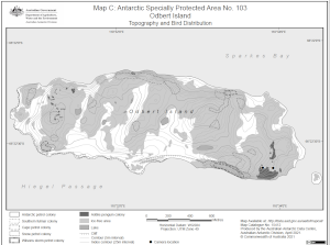
Antarctic Specially Protected Area No. 103
Odbert Island
Map C: Topography and Bird Distribution
View Map Details
Map ID - 15412
Published On -
April-2021
Scale -
1 : 15 000
Physical Size-
15 x 20 cm
|