Antarctica and the Southern Ocean
View All Map ListsMaps of Antarctica and the Southern Ocean
Showing 21 to 38 of 38 maps. On page 2 of 2, go to the Previous Page
Antarctica and the Southern Ocean: CCAMLR Statistical Reporting Subareas
|
Antarctica and the Southern Ocean: main Antarctic facilities operated by the National Antarctic Programs in the Antarctic Treaty area (south of 60° latitude south) [Folding map version] View Map Details
Map ID - 13321
Published On - May-2006 Scale - 1 : 17 000 000 Physical Size- 42 x 59.5 cm ![Antarctica and the Southern Ocean: main Antarctic facilities operated by the National Antarctic Programs in the Antarctic Treaty area (south of 60° latitude south)
[Folding map version]](/database/mapcat/sthn_ocean/COMNAP_Inside_A2_Brochure_13321_thumb.jpg)
|
Antarctica and the Southern Ocean
|
Antarctica in relation to Australia View Map Details
Map ID - 14481
Published On - September-2015 Scale - 1 : 48 000 000 Physical Size- 22.5 x 22 cm 
|
Antarctica in relation to Australia
|
Base map of Antarctica and the Southern Ocean View Map Details
Map ID - 13351
Published On - January-2007 Scale - 1 : 60 000 000 Physical Size- 29.7 x 21 cm A4 
|
Census of Antarctic Marine Life View Map Details
Map ID - 13186
Published On - September-2005 Scale - 1 : 60 000 000 Physical Size- 29.7 x 21 cm A4 
|
Features of the Southern Ocean
|
Kerguelen Plateau to Antarctica View Map Details
Map ID - 14033
Published On - February-2013 Scale - 1 : 4 000 000 Physical Size- 98 x 96 cm 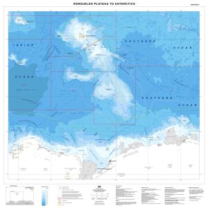
|
Northern boundary of the Antarctic Circumpolar Current View Map Details
Map ID - 13009
Published On - February-2003 Scale - 1 : 70 000 000 Physical Size- - 
|
Physical features of the Southern Ocean View Map Details
Map ID - 13063
Published On - February-2004 Scale - 1 : 65 000 000 Physical Size- 16 x 16 cm 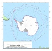
|
Physical features of the Southern Ocean View Map Details
Map ID - 13011
Published On - September-2002 Scale - 1 : 20 000 000 Physical Size- 52 x 52 cm 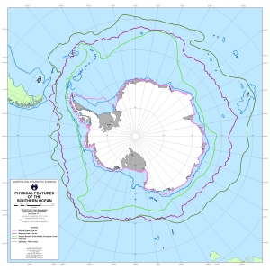
|
Principal voyages contributing to the Census of Antarctic Marine Life View Map Details
Map ID - 13478
Published On - May-2008 Scale - 1 : 80 000 000 Physical Size- 16.5 x 13.5 cm 
|
Stations in Antarctica
|
Stations in Antarctica
|
Stations in Antarctica
|
Subantarctic islands View Map Details
Map ID - 13991
Published On - September-2011 Scale - 1 : 100 000 000 Physical Size- 12 x 12 cm 
|
Subantarctic islands [Black and white] View Map Details
Map ID - 13137
Published On - April-2005 Scale - 1 : 234 190 300 Physical Size- 5.4 x 5.3 cm ![Subantarctic islands [Black and white]](https://data.aad.gov.au/database/mapcat/sthn_ocean/subantarctic_islands_thumb.jpg)
|
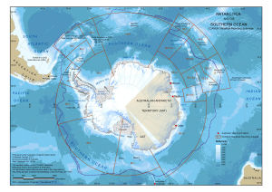

![Antarctica in relation to Australia<br>
[With the Polar Front shown]](/database/mapcat/sthn_ocean/antarctica_and_australia_14249_thumb.jpg)

![Stations in Antarctica<br>
[with Australian Exclusive Economic Zones and southern continents shown]](/database/mapcat/sthn_ocean/antarctica_continents_stations_14243_thumb.jpg)
![Stations in Antarctica<br>
[with Australian Exclusive Economic Zones and southern continents shown]](/database/mapcat/sthn_ocean/antarctica_continents_stations_14257_thumb.jpg)
![Stations in Antarctica<br>
[with southern continents shown]](/database/mapcat/sthn_ocean/antarctica_continents_stations_14267_thumb.jpg)
Showing 21 to 38 of 38 maps. On page 2 of 2, go to the Previous Page