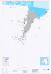
Map 12961: Regional Map - Prince Charles Mountains, Lambert Glacier and Amery Ice Shelf
Map details
| Map Number | 12961 |
| Title | Regional Map - Prince Charles Mountains, Lambert Glacier and Amery Ice Shelf |
| Edition | 1 |
| Scale | 1 : 1 000 000 |
| Publication date | April 2003 |
| Publisher |
Australian Antarctic Division (Australia)
|
| Spatial coverage |
( 58.0000° -67.0000°)
,
( 80.0000° -67.0000°)
,
( 80.0000° -78.0000°)
( 58.0000° -78.0000°) |
| Projection | Lambert Conformal Conic |
| Physical size | 142 x 95 cm |
| Reference | 12961 |
| Keywords | Prince Charles Mountains , Lambert Glacier , Amery Ice Shelf , Regional Map , Topographic |
Downloads
This is a hard copy map that has been scanned. See information about obtaining copies of hard copy maps.
- A print file (PDF)
- A print file (EPS), gzipped
- A LZW compressed TIFF
- 'A zipped image (TIF) for use in Oziexplorer'
Map Lists
This map belongs to the following lists. Use the link on the list to see all maps belonging to that list
Additional Information
| Horizontal datum | WGS84 |
| Vertical datum | Mean sea level |
| Magnetic variation | 66 degrees 14 minutes west at Mawson, 78 degrees 31 minutes west at Davis, 70 degrees 51 minutes west at Mt Cresswell |
| Nomenclature | Australian Antarctic Names Gazetteer |
Preview