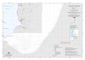
Map 16010: Windmill Islands : Map 4 of 5
Map details
| Map Number | 16010 |
| Title | Windmill Islands : Map 4 of 5 |
| Edition | 12 |
| Previous edition | [Previous edition : 11] |
| Scale | 1 : 50 000 |
| Publication date | September 2023 |
| Publisher |
Australian Antarctic Division (Australia)
|
| Spatial coverage |
(110.6270° -66.4295°)
,
(111.0672° -66.4295°)
,
(111.0672° -66.5490°)
(110.6270° -66.5490°) |
| Projection | Universal Transverse Mercator |
| Physical size | 29.7 x 42 cm A3 |
| Keywords | Campbell Nunatak , Alexander Nunataks , Longs Nunatak , Haupt Nunataks , Station Operational Area , Topographic |
Downloads
This is a digital map available for downloading.
Map Lists
This map belongs to the following lists. Use the link on the list to see all maps belonging to that list
Additional Information
| Horizontal datum | WGS 84 |
| Vertical datum | Mean sea level |
| Vertical unit | Metres |
| Magnetic variation | Magnetic North is 103 degrees west of True North |
| Nomenclature | Australian Antarctic Gazetteer |
Preview