ANARE Catalogue of Maps and Hydrographic Charts 1997
View All Map ListsThe map below shows the extents of each map in this list Alt+Shift+Drag to rotate the map
Showing 41 to 60 of 85 maps. On page 3 of 5, go to the Previous Page or Next Page
Preliminary - Mawson Coast, Mac.Robertson Land View Map Details
Map ID - 14061
Published On - September-1991 Scale - 1 : 500 000 Physical Size- 75 x 69 cm 
|
Preliminary - Mount Menzies View Map Details
Map ID - 933
Published On - 1975 Scale - 1 : 250 000 Physical Size- 72 x 102 cm 
|
Preliminary - Oygarden and Law Promontory View Map Details
Map ID - 928
Published On - 1967 Scale - 1 : 250 000 Physical Size- 59.5 x 84 cm 
|
Prydz Bay View Map Details
Map ID - 7
Published On - September-1997 Scale - 1 : 1 000 000 Physical Size- 70 x 75 cm 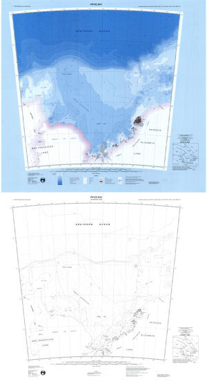
|
Prydz Bay - Amery Ice Shelf View Map Details
Map ID - 435
Published On - March-1996 Scale - 1 : 500 000 Physical Size- 64 x 99 cm
No previews available
|
Prydz Bay - Edward VIII Gulf to Mawson View Map Details
Map ID - 437
Published On - March-1996 Scale - 1 : 500 000 Physical Size- 81.5 x 86.5 cm
No previews available
|
Prydz Bay - Four Ladies' Bank View Map Details
Map ID - 433
Published On - March-1996 Scale - 1 : 500 000 Physical Size- 84 x 110 cm
No previews available
|
Prydz Bay - Mawson to Prydz Bay View Map Details
Map ID - 431
Published On - March-1996 Scale - 1 : 500 000 Physical Size- 84 x 110 cm
No previews available
|
Rauer Group / Princess Elizabeth Land View Map Details
Map ID - 48
Published On - June-1992 Scale - 1 : 50 000 Physical Size- 93 x 69 cm 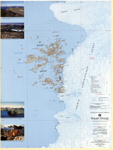
|
Rauer Group / Princess Elizabeth Land View Map Details
Map ID - 47
Published On - June-1991 Scale - 1 : 50 000 Physical Size- 93 x 69 cm 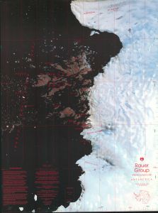
|
Sandefjord Bay, Princess Elizabeth Land View Map Details
Map ID - 69
Published On - August-1993 Scale - 1 : 100 000 Physical Size- 69 x 99.6 cm 
|
Scylla Glacier, Mac.Robertson Land View Map Details
Map ID - 70
Published On - July-1992 Scale - 1 : 100 000 Physical Size- 69.5 x 99.5 cm 
|
Sheet SQ 38-39/11, Mount Riiser-Larsen, Australian Antarctic Territory, Enderby Land [SQ 39-40/16] View Map Details
Map ID - 96
Published On - March-1963 Scale - 1 : 250 000 Physical Size- 68.5 x 67 cm ![Sheet SQ 38-39/11, Mount Riiser-Larsen, Australian Antarctic Territory, Enderby Land [SQ 39-40/16]](/database/mapcat/250k/SQ38-39_11_1963_250k_96_thumb.jpg)
|
Sheet SQ 38-39/14, Tange Promontory, Australian Antarctic Territory, Enderby Land [SQ 37-38/16] View Map Details
Map ID - 107
Published On - August-1962 Scale - 1 : 250 000 Physical Size- 69.5 x 64.5 cm ![Sheet SQ 38-39/14, Tange Promontory, Australian Antarctic Territory, Enderby Land [SQ 37-38/16]](/database/mapcat/250k/SQ38-39_14_1962_250k_107_thumb.jpg)
|
Sheet SQ 38-39/15, Simpson Peak, Australian Antarctic Territory, Enderby Land [SQ 39-40/13] View Map Details
Map ID - 104
Published On - August-1962 Scale - 1 : 250 000 Physical Size- 69.5 x 65 cm ![Sheet SQ 38-39/15, Simpson Peak, Australian Antarctic Territory, Enderby Land [SQ 39-40/13]](/database/mapcat/250k/SQ38-39_15_1962_250k_104_thumb.jpg)
|
Sheet SQ 38-39/16, McLeod Nunataks, Australian Antarctic Territory, Enderby Land [SQ 39-40/14] View Map Details
Map ID - 90
Published On - March-1964 Scale - 1 : 250 000 Physical Size- 67 x 67 cm ![Sheet SQ 38-39/16, McLeod Nunataks, Australian Antarctic Territory, Enderby Land [SQ 39-40/14]](/database/mapcat/250k/SQ38-39_16_1964_250k_90_thumb.jpg)
|
Sheet SQ 40-41/10, Oygarden Group, Australian Antarctic Territory, Kemp Land [SQ 39-40/12] View Map Details
Map ID - 99
Published On - May-1966 Scale - 1 : 250 000 Physical Size- 67 x 67 cm ![Sheet SQ 40-41/10, Oygarden Group, Australian Antarctic Territory, Kemp Land [SQ 39-40/12]](/database/mapcat/250k/SQ40-41_10_1966_250k_99_thumb.jpg)
|
Sheet SQ 40-41/14, Law Promontory, Australian Antarctic Territory, Kemp Land [SQ 39-40/16] View Map Details
Map ID - 86
Published On - May-1966 Scale - 1 : 250 000 Physical Size- 67 x 67 cm ![Sheet SQ 40-41/14, Law Promontory, Australian Antarctic Territory, Kemp Land [SQ 39-40/16]](/database/mapcat/250k/SQ40-41_14_1966_250k_86_thumb.jpg)
|
Sheet SQ 41-42/15, Scullin Monolith, Australian Antarctic Territory, Mac. Robertson Land View Map Details
Map ID - 103
Published On - March-1970 Scale - 1 : 250 000 Physical Size- 65 x 60.5 cm 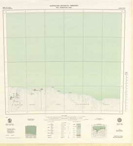
|
Sheet SQ 49-50/9, Vincennes Bay, Australian Antarctic Territory, Wilkes Land View Map Details
Map ID - 108
Published On - March-1969 Scale - 1 : 250 000 Physical Size- 67 x 67 cm 
|
Showing 41 to 60 of 85 maps. On page 3 of 5, go to the Previous Page or Next Page