Classroom Antarctica
View All Map ListsMaps used for Classroom Antarctica
Showing 1 to 20 of 48 maps. On page 1 of 3, go to the Next Page
Antarctica and the Southern Ocean
|
Antarctica : 1000 metre contours View Map Details
Map ID - 13642
Published On - June-2009 Scale - 1 : 45 000 000 Physical Size- 29.7 x 21 cm A4 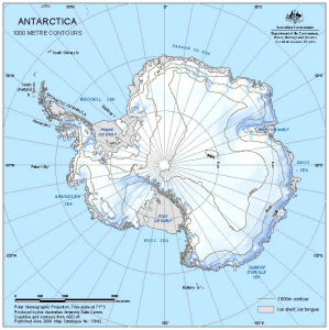
|
Antarctica : 500 metre contours View Map Details
Map ID - 13641
Published On - June-2009 Scale - 1 : 45 000 000 Physical Size- 29.7 x 21 cm A4 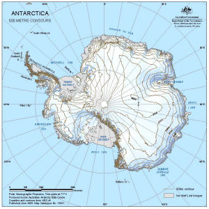
|
Antarctica [Black and white A4] View Map Details
Map ID - 13154
Published On - June-2005 Scale - 1 : 34 970 000 Physical Size- - ![Antarctica [Black and white A4]](/database/mapcat/antarctica/antarctica_b&w_A4_thumb.jpg)
|
Antarctica [Black and white] View Map Details
Map ID - 13202
Published On - November-2005 Scale - 1 : 64 021 800 Physical Size- 10.3 x 10.3 cm ![Antarctica [Black and white]](/database/mapcat/antarctica/ant_b&w_13202_thumb.jpg)
|
Antarctica [Black and white] View Map Details
Map ID - 13117
Published On - November-2004 Scale - 1 : 60 140 000 Physical Size- 11.4 x 11.1 cm ![Antarctica [Black and white]](/database/mapcat/antarctica/antarctica_b&w_thumb.jpg)
|
Antarctica and the Southern Ocean View Map Details
Map ID - 13323
Published On - September-2006 Scale - 1 : 57 000 000 Physical Size- - 
|
Antarctica and the Southern Ocean View Map Details
Map ID - 12183
Published On - June-2000 Scale - 1 : 35 000 000 Physical Size- 29.7 x 42 cm A3 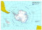
|
Antarctica and the Southern Ocean [Black and white] View Map Details
Map ID - 14289
Published On - May-2014 Scale - 1 : 116 000 000 Physical Size- 8.5 x 8.5 cm ![Antarctica and the Southern Ocean [Black and white]](/database/mapcat/sthn_ocean/antarctica_sthn_ocean_bw_14289_thumb.jpg)
|
Antarctica on top [Black and white A4] View Map Details
Map ID - 13572
Published On - November-2008 Scale - 1 : 48 000 000 Physical Size- 21 x 29.7 cm A4 ![Antarctica on top [Black and white A4]](/database/mapcat/sthn_hemisphere/antarctica_on_top_bw_13572_thumb.jpg)
|
Antarctica with hill shading [Black and white] View Map Details
Map ID - 13469
Published On - April-2008 Scale - 1 : c59 259 900 Physical Size- 9.7 x 10 cm ![Antarctica with hill shading [Black and white]](/database/mapcat/antarctica/13469_antarctica_map_bw_thumb.jpg)
|
Antarctica
|
Area comparison - Antarctica, Australia and the UK View Map Details
Map ID - 13646
Published On - June-2009 Scale - 1 : 35 000 000 Physical Size- - 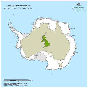
|
Australia and the Australian Antarctic Territory View Map Details
Map ID - 14603
Published On - July-2017 Scale - 1 : 38 900 000 Physical Size- 30.5 x 21 cm 
|
Australia to the Australian Antarctic Territory - Plot your route View Map Details
Map ID - 12145
Published On - July-2000 Scale - Not Entered Physical Size- 21 x 29.7 cm A4 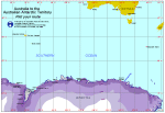
|
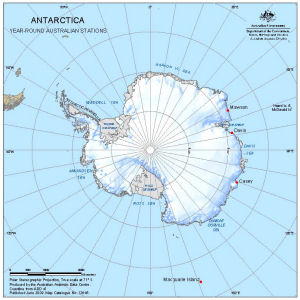
Australian Antarctic year-round stations View Map Details
Map ID - 13416
Published On - July-2007 Scale - 1 : 53 000 000 Physical Size- 13.2 x 12.9 cm 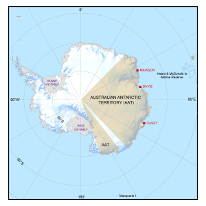
|
Australian Antarctic year-round stations View Map Details
Map ID - 13320
Published On - September-2006 Scale - 1 : 50 000 000 Physical Size- 13.2 x 12.9 cm 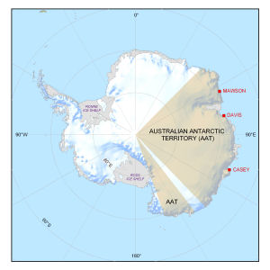
|
Australian Stations in Antarctica View Map Details
Map ID - 13682
Published On - July-2009 Scale - 1 : 25 000 000 Physical Size- 19.7 x 19.7 cm 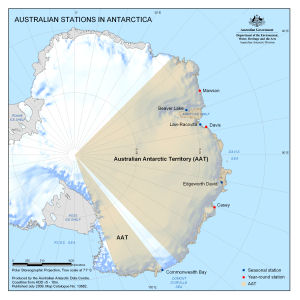
|
Casey: Buildings and Structures View Map Details
Map ID - 15821
Published On - October-2022 Scale - 1 : 2500 Physical Size- 21 x 29.7 cm A4 Vertical Unit - Meters 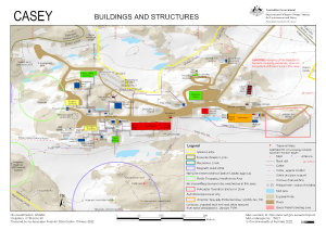
|
Casey: Recreation Limits View Map Details
Map ID - 16005
Published On - September-2023 Scale - 1 : 15 500 Physical Size- 21 x 29.7 cm A4 Vertical Unit - Meters 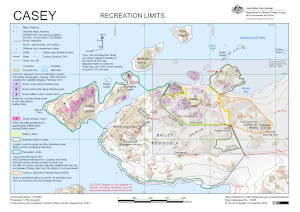
|
![Antarctica and the Southern Ocean<br>
including year-round Australian stations [Black and white]](/database/mapcat/sthn_ocean/antarctica_ps_14159_thumb.jpg)
Showing 1 to 20 of 48 maps. On page 1 of 3, go to the Next Page