Classroom Antarctica
View All Map ListsMaps used for Classroom Antarctica
Showing 21 to 40 of 48 maps. On page 2 of 3, go to the Previous Page or Next Page
Casey: Station Limits View Map Details
Map ID - 16006
Published On - September-2023 Scale - 1 : 8600 Physical Size- 21 x 29.7 cm A4 Vertical Unit - Meters 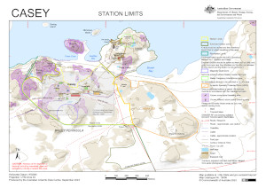
|
Comparison Map of Antarctica and Australia View Map Details
Map ID - 13648
Published On - June-2009 Scale - 1 : 35 000 000 Physical Size- 29.7 x 21 cm A4 
|
Comparison Map of Antarctica, Australian Antarctic Territory and Australia View Map Details
Map ID - 13675
Published On - July-2009 Scale - 1 : 35 000 000 Physical Size- 29.7 x 21 cm A4 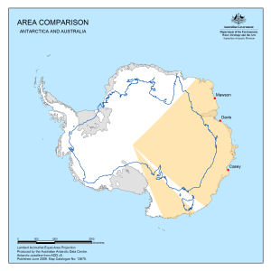
|
Comparison Map of Antarctica, New Zealand and Australia View Map Details
Map ID - 13647
Published On - June-2009 Scale - 1 : 35 000 000 Physical Size- 29.7 x 21 cm A4 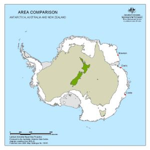
|
Heard Island View Map Details
Map ID - 11253
Published On - July-1999 Scale - 1 : 170 000 Physical Size- 21 x 29.7 cm A4 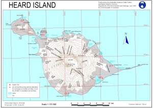
|
Heard Island - main wildlife concentrations (Helicopter Operations) View Map Details
Map ID - 12583
Published On - August-2000 Scale - 1 : 180 000 Physical Size- 21 x 29.7 cm A4 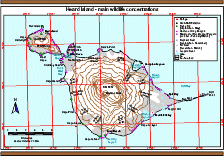
|
Heard Island [Black and white] View Map Details
Map ID - 13138
Published On - May-2005 Scale - 1 : 853 600 Physical Size- 4 x 5.5 cm ![Heard Island [Black and white]](/database/mapcat/heard/heard_island_bw_thumb.jpg)
|
Heard Island and Macquarie Island in relation to Australia and Antarctica [Black and white] View Map Details
Map ID - 13994
Published On - September-2011 Scale - 1 : 122 830 256 Physical Size- 3.7 x 4.7 cm ![Heard Island and Macquarie Island in relation to Australia and Antarctica [Black and white]](/database/mapcat/heard/heard_location_ps_bw_13994_thumb.jpg)
|
Heard Island and McDonald Islands View Map Details
Map ID - 13099
Published On - August-2004 Scale - 1 : 210 000 Physical Size- 21 x 29.7 cm A4 Vertical Unit - Meters 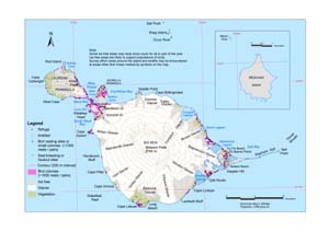
|
Heard Island and McDonald Islands Management Zones View Map Details
Map ID - 13100
Published On - August-2004 Scale - 1 : 194 320 Physical Size- 21 x 29.7 cm A4 Vertical Unit - Meters 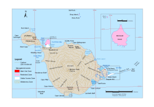
|
Heard Island in relation to Australia and Antarctica [Black and white] View Map Details
Map ID - 13134
Published On - March-2005 Scale - 1 : 132 100 000 Physical Size- 3.7 x 4.7 cm ![Heard Island in relation to Australia and Antarctica [Black and white]](https://data.aad.gov.au/database/mapcat/heard/heard_australia_antarctica_thumb.jpg)
|
Holme Bay with Antarctic inset [Black and white] View Map Details
Map ID - 13155
Published On - June-2005 Scale - 1 : 261 300 Physical Size- 6 x 10 cm ![Holme Bay with Antarctic inset [Black and white]](/database/mapcat/holme/holme_bay_bw_with_ant_inset_thumb.jpg)
|
Location of Macquarie Island in relation to Australia and Antarctica [Black and white] View Map Details
Map ID - 13143
Published On - May-2005 Scale - 1 : c139 928 200 Physical Size- 4.5 x 5.5 cm ![Location of Macquarie Island in relation to Australia and Antarctica [Black and white]](/database/mapcat/maccais/macca_location_bw_thumb.jpg)
|
Macquarie Island View Map Details
Map ID - 12977
Published On - 2003 Scale - 1 : 410 000 Physical Size- 10 x 6 cm 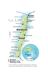
|
Macquarie Island View Map Details
Map ID - 12060
Published On - July-2000 Scale - Not Entered Physical Size- 29.7 x 21 cm A4 
|
Macquarie Island [Black and white A4] View Map Details
Map ID - 13265
Published On - April-2006 Scale - 1 : 150 000 Physical Size- 29.7 x 21 cm A4 ![Macquarie Island [Black and white A4]](/database/mapcat/maccais/macca_A4_bw_13265_thumb.jpg)
|
Macquarie Island Refuges View Map Details
Map ID - 13023
Published On - September-2003 Scale - 1 : 450 000 Physical Size- 8.5 x 5.3 cm 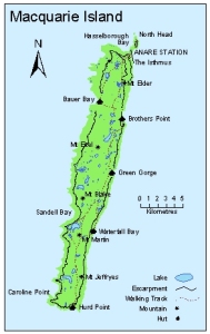
|
Mawson: Buildings and Structures View Map Details
Map ID - 15775
Published On - October-2022 Scale - 1 : 3000 Physical Size- 29.7 x 21 cm A4 Vertical Unit - Meters 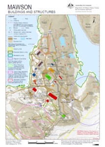
|
Mawson: Recreation Limits View Map Details
Map ID - 15777
Published On - October-2022 Scale - 1 : 11 500 Physical Size- 29.7 x 21 cm A4 Vertical Unit - Meters 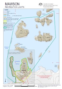
|
Mawson: Station Limits View Map Details
Map ID - 15776
Published On - August-2022 Scale - 1 : 5500 Physical Size- 29.7 x 21 cm A4 Vertical Unit - Meters 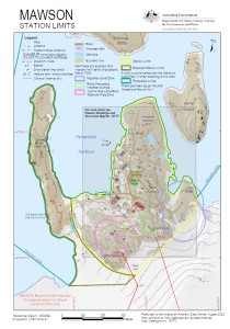
|
Showing 21 to 40 of 48 maps. On page 2 of 3, go to the Previous Page or Next Page