Cape Denison / Commonwealth Bay
View All Map ListsShowing 1 to 20 of 33 maps. On page 1 of 2, go to the Next Page
A.A.E. [Australasian Antarctic Expedition] 1911-14
|
Adelie Land and King George Land adjacent to the Cape Denison station View Map Details
Map ID - 13612
Published On - 1942 Scale - 1 : 355 000 Physical Size- 14 x 22.5 cm 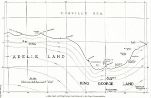
|
Aus 603 Australian Antarctic Territory - George V Land - Approaches to Commonwealth Bay View Map Details
Map ID - 14023
Published On - July-2011 Scale - 1 : 25 000 Physical Size- 110 x 70 cm 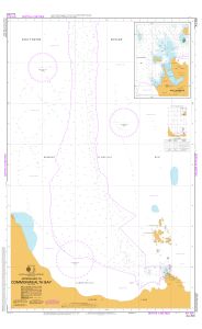
|
Australasian Antarctic Expedition : King George V Land showing tracks of the Eastern Sledging Parties from the Main Base View Map Details
Map ID - 3697
Published On - 1914 Scale - 1 : 1 000 000 Physical Size- 37 x 52 cm 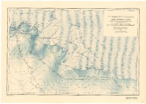
|
Australian Antarctic Territory - Cape Denison View Map Details
Map ID - 13570
Published On - November-2008 Scale - 1 : 5000 Physical Size- 32 x 43 cm A3 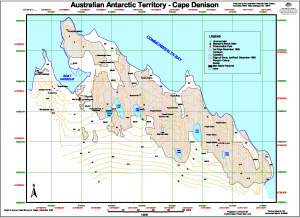
|
Australian Antarctic Territory - Cape Denison View Map Details
Map ID - 12719
Published On - February-2001 Scale - 1 : 2500 Physical Size- 60 x 84 cm 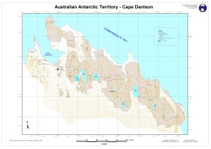
|
Australian Antarctic Territory - Cape Denison View Map Details
Map ID - 12720
Published On - February-2001 Scale - 1 : 750 Physical Size- 60 x 84 cm 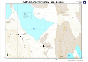
|
Australian Antarctic Territory - Cape Denison : Survey marks View Map Details
Map ID - 13446
Published On - February-2001 Scale - 1 : 2500 Physical Size- 60 x 84 cm 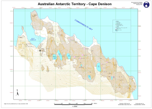
|
Cape Denison View Map Details
Map ID - 13855
Published On - August-2010 Scale - 1 : 7500 Physical Size- 21 x 29.7 cm A4 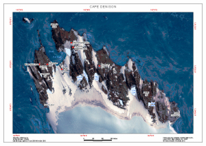
|
Cape Denison View Map Details
Map ID - 12143
Published On - June-2000 Scale - Not Entered Physical Size- 21 x 29.7 cm A4 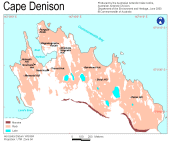
|
Cape Denison - George V Land Coast View Map Details
Map ID - 12755
Published On - December-2001 Scale - 1 : 5000 Physical Size- 46 x 51 cm 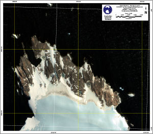
|
Cape Denison (ASPA 162) (Helicopter Operations) View Map Details
Map ID - 14309
Published On - July-2014 Scale - 1 : 8000 Physical Size- 21 x 29.7 cm A4 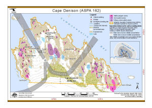
|
Cape Denison (OUT OF DATE) View Map Details
Map ID - 13575
Published On - April-2010 Scale - 1 : 5000 Physical Size- 29.7 x 42 cm A3 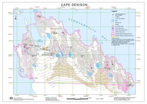
|
Cape Denison : Mawson's huts historic site View Map Details
Map ID - 13119
Published On - 2003 Scale - 1 : 8420 Physical Size- 21 x 34.5 cm 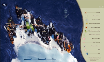
|
Cape Denison and Mackellar Islands - George V Land Coast View Map Details
Map ID - 12754
Published On - December-2001 Scale - 1 : 10 000 Physical Size- 92.5 x 80 cm 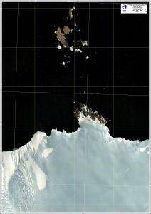
|
Cape Denison Antarctic Specially Protected Area No. 162 View Map Details
Map ID - 14282
Published On - March-2014 Scale - 1 : 20 000 Physical Size- 7.5 x 10 cm 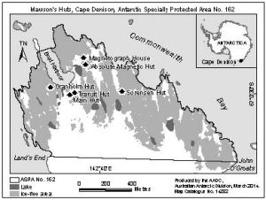
|
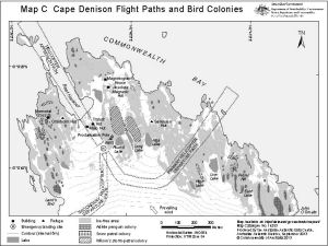
Cape Denison Flight Paths and Bird Colonies
|
Cape Denison Historic Huts and Wildlife View Map Details
Map ID - 13956
Published On - June-2011 Scale - 1 : 10 000 Physical Size- 7.5 x 10 cm 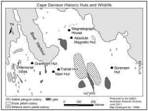
|
Cape Denison Historic Site - Commonwealth Bay Antarctica View Map Details
Map ID - 156
Published On - November-1990 Scale - 1 : 3300 Physical Size- 62.5 x 83.5 cm 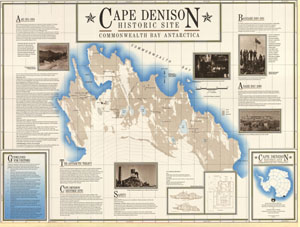
|
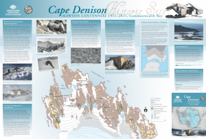
Cape Denison Historic Site
|
![A.A.E. [Australasian Antarctic Expedition] 1911-14<br>
King George Land](/database/mapcat/Historical/AAE_KingGeorgeLand_1914_14047_thumb.jpg)
Showing 1 to 20 of 33 maps. On page 1 of 2, go to the Next Page